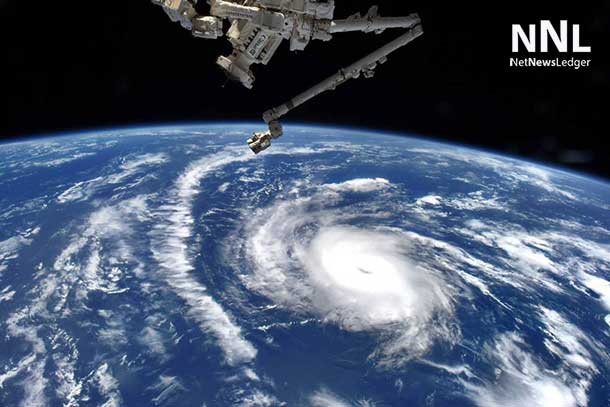
HOUSTON – WEATHER – Astronauts aboard the International Space Station captured an image of Hurricane Danny moving through the Central Atlantic Ocean. Satellite data indicates that Danny is a small Category 2 hurricane, in which hurricane-force winds only extend 15 miles from the eye.
A NASA GOES Project animation of visible and infrared imagery of Hurricane Danny was created at NASA’s Goddard Space Flight Center in Greenbelt, Maryland to show the development and movement of the storm. The animation shows the eastern and central Atlantic Ocean from Aug. 18 to 21, 2015.
Forecaster Cangialosi of the National Hurricane Center noted that the eye of the compact hurricane has become more distinct recently and the cloud tops have cooled in the eyewall. Infrared data, such as that gathered by the Atmospheric Infrared Sounder (AIRS) instrument that flies aboard NASA’s Aqua satellite is used to determine cloud top temperature. The colder the cloud tops, the higher they are in the atmosphere, and they are usually stronger.

At 11 a.m. EDT (1500 UTC) on August 21, the eye of Hurricane Danny was located near latitude 14.0 North, longitude 48.2 West. That puts the center of Danny about 930 miles (1,195 km) east of the Leeward Islands. Maximum sustained winds have increased to near 105 mph (165 kph), making Danny a Category 2 hurricane on the Saffir-Simpson Hurricane Wind Scale. The estimated minimum central pressure is 976 millibars.
Satellite data shows that hurricane force winds extend outward up to 15 miles (30 km) from the center and tropical storm force winds extend outward up to 70 miles (110 km).
Danny is moving toward the west-northwest near 10 mph (17 kph), and this general motion is expected to continue during the next day or so.
On August 22, Danny is expected to move into an area of increased southwesterly shear and drier air. These factors should induce a weakening trend. The National Hurricane Center (NHC) expects Danny to weaken below hurricane strength as it approaches the Caribbean islands.
