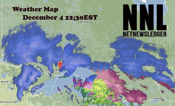
Thunder Bay and Northern Ontario Winter Storm
THUNDER BAY – Weather – The Snowfall Warning is continued for much of Northwestern and Northern Ontario. Environment Canada at 21:30EST reports, “Significant snowfall tonight into early Thursday morning”.
A strengthening low pressure system over Wisconsin will track northeast reaching Lake Superior tonight and James Bay Thursday evening. An area of snow is spreading into Northwestern Ontario and will spread into Superior North by late afternoon then northeast towards Geraldton and Kapuskasing early this evening.
Across Thunder Bay city streets are mostly snow packed. Blowing snow is hampering visibility in some cases.
Up to 25cm of Snow Possible
Total snowfall amounts of 15 to 25 centimetres will be possible by the time the snow tapers off on Thursday for many regions. Regions closer to the Manitoba border will see lesser amounts with up to 15 centimetres expected by Thursday. In addition, brisk and gusty winds will likely accompany the storm reducing visibilities in blowing snow.
For the Kapuskasing region, snow may briefly change to ice pellets and freezing rain then rain early Thursday morning before temperatures drop and a transition back to flurries occurs.
School Buses Cancelled
Please be advised that school buses have been cancelled for the day on Thursday, December 5 in the following areas:
Sioux Lookout
Red Lake/Ear Falls
Kenora/Sioux Narrows
Dryden/Vermilion Bay
Upsala/Ignace
Please be reminded that all schools will remain open and only the school buses have been cancelled in these areas.
Pickle Lake is still scheduled to operate in the morning.
At 10:30EST all Thunder Bay Schools and buses are still scheduled to be open and running.
Helpful Winter Storm Links
Lastest Weather: NNL Weather
Latest Road Conditions: NNL Winter Driving Conditions
Airport Arrivals and Departures: NNL Airport Flight Tracking


