
Rain, Thunder & Flurries: A Weekend Weather Mash-Up
A Special Weather Statement is in effect for Thunder Bay and the Lakehead Region, with rainfall, melting snow, and potential thunderstorms creating flooding risks today. By tonight, temperatures plunge below freezing, turning everything slippery and icy. If you’re heading out, watch for pooling water and slick surfaces!
Saturday, March 15: Rainy Start, Icy Finish
The morning starts at 3°C, with humidity at 92% and barometric pressure falling at 98.6 kPa—a sure sign of incoming unsettled weather. Periods of rain will persist through the day, with 10 to 15 mm expected, though thunderstorms could push totals higher in some areas.
Fog patches will dissipate by mid-morning, but expect gusty east winds at 23 km/h, gusting to 32 km/h. Temperatures will climb to 10°C, making for a mild but soggy day.
By evening, a major change arrives—rain transitions to snow near midnight, with blustery northwest winds at 30 km/h, gusting to 50 km/h. Temperatures drop rapidly to -9°C, with wind chills making it feel like a brutal -17°C overnight. Any leftover moisture will freeze, creating icy roads and sidewalks.
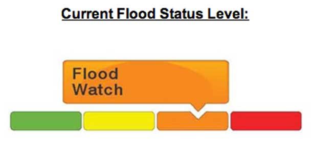
LRCA Issues Flood Watch
The Lakehead Region Conservation Authority has issued a Flood Watch for the Lakehead Region including: City of Thunder Bay, Municipalities of Neebing, Oliver Paipoonge, Shuniah and the Townships of O’Connor, Conmee, Gillies and Dorion.
The Lakehead Region Conservation Authority advises that rainfall and above freezing temperatures are forecasted over the weekend with the potential for localized thunderstorms in some areas. Slightly below average snowpack has been recorded today in local snow monitoring locations ranging from 23 to 46 centimetres depth with 80 to 101 millimetres of equivalent water.
The combined snowmelt and rainfall could cause significant runoff due to the frozen ground, ditches and waterways. Area watercourses and low-lying areas may experience a rise in levels and ponding in response over the weekend.
The public is advised to pay attention to local forecasts, and exercise caution in and around area waterways. High flows and unstable slippery banks could be dangerous. Parents and caregivers are advised to keep pets and children away from all waterways and discuss the hazards of unstable ice and cold fast flowing water. Additionally, never drive through a flooded road.
A Flood Watch is issued when the assessed conditions indicate that the potential for flooding exists. Authority Staff will continue to monitor conditions as part of its flood forecasting and warning program.
This message will remain in effect until 10:00 a.m. Monday March 17, 2025.
Sunday, March 16: A Cold & Blustery Day
Sunday starts off mainly cloudy, with a 40% chance of morning flurries. The wind stays northwest at 20 km/h, gusting to 40 km/h, keeping things blustery and cold.
The high only reaches -4°C, but morning wind chills will make it feel like -17°C, improving slightly to -10°C by the afternoon. By night, skies will clear a bit, but it stays cold with a low of -10°C.
Monday, March 17: A Snowy St. Patrick’s Day?
Monday starts with a mix of sun and clouds, but there’s a 60% chance of snow, so don’t be surprised if the city gets a fresh dusting.
The high rises to 2°C, offering a slight break from the deep freeze. By night, the chance of flurries drops to 30%, with a low of -9°C.
What to Wear?
- Saturday: A rain jacket and waterproof boots for the wet start, but keep winter layers handy—temps will drop fast by evening.
- Sunday: Full winter gear—hat, gloves, and a warm coat. Wind chills will make it feel much colder than the thermometer says.
- Monday: A winter jacket with layers—snow is likely, but temperatures will be a bit milder.
Thunder Bay Weather Trivia
Did you know? The heaviest single-day rainfall recorded in March in Thunder Bay was 38.1 mm on March 26, 1976. While today’s rain won’t break records, it could still cause localized flooding.


