28 New Fires – 148 Active Fires
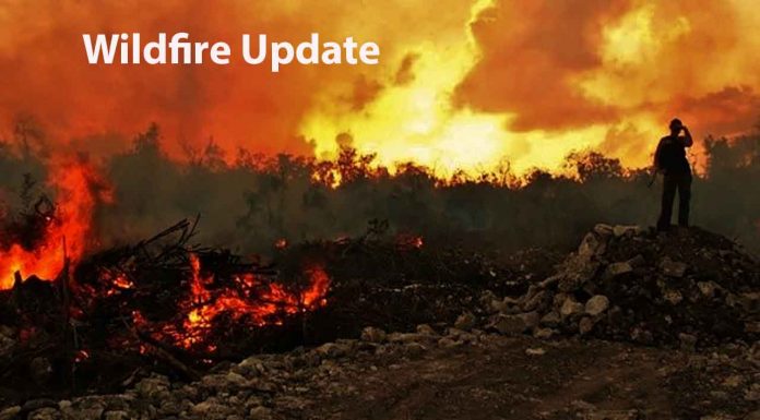
Thunder Bay – Wildfire Update – There were 28 new fires confirmed in the northwest region by the early evening of July 29.
At the time of this update there were 148 active fires in the northwest region. A total of 59 fires were not under control, seven fires were being held, 22 fires were under control and 60 fires were being observed. Fifteen fires were called out today.
- These fires are located in the following districts: Fort Frances (10), Kenora (7); Sioux Lookout (4), Red Lake (3), Thunder Bay (2) and Dryden (2) No new fires were found in the Nipigon District.
- The wildland fire hazard ranges from high to extreme in the Kenora District, to a full range of conditions – from low to extreme – the result of localized showers in Red Lake, Sioux Lookout, Dryden, Fort Frances, Thunder Bay and Nipigon Districts.
- To see the specific wildland fire hazard in your area check the interactive fire map at Ontario.ca/forestfire
Fires of Note
Red Lake 65 – of concern to Poplar Hill First Nation
- Fire has been remapped to 18,330 hectares and is 6 km northwest of the community.
- The eastern edge of the fire continues to be monitored.
- Crews are actioning a small section of the northeast side of the fire and are supported by a bucketing helicopter.
- On July 28th the fire was more active with some areas showing open flame and single tree torching. Windier weather may increase fire behaviour in areas of more active burning along the east flank.
- Increased smoke in the community is expected due to active fires along the Manitoba boarder and winds from the west.
- An ignition team is assigned to the fire
- Four crews are assigned to protect the community and critical infrastructure as well as on the fireline.
- The Ministry of the Solicitor General has coordinated an evacuation of the community.
Red Lake 51 – of concern to Deer Lake First Nation
- Fire size is sized at 51,926 hectares and is located approximately 24 kilometres west of the community.
- Due to winds there has been increased smoke cover across the area.
- Three crews are focused on the protection of the community and critical infrastructure.
- The Ministry of the Solicitor General has coordinated an evacuation of the community.
Sioux Lookout 60 – of concern to Cat lake First Nation
- The fire is 1487 hectares and located 8 kilometres west of the community.
- The fire displayed limited activity in recent days due to weather conditions
- Community protection efforts are ongoing.
- 8 crews are assigned to the fire. Crews are working hoselines on the fire
- An Incident Management Team from Nova Scotia is managing the fire.
Red Lake 77 – Fire of concern to Red Lake
- Fire is not under control and has been remapped to 27,172 hectares.
- Red Lake 77 is approximately 28 kilometres west/northwest of Madsen and is located approximately 33 kilometres west of Red Lake.
- Fire behaviour on the east side has increased today under drier conditions.
- A total of 30 pieces of heavy equipment and their operators have been engaged in building approximately 40 kilometres of fire guard in strategic areas.
- Fireguard continues to be built east of the fire, heavy equipment is making good progress.
- Bucketing helicopters are working along the fire’s edge to reduce fire behaviour.
- Crews are working alongside municipal firefighters to protect the community and critical infrastructure.
Kenora 51
- Fire is not under control and is 171,148 hectares.
- Fire has been active over the past several days producing smoke at the local level.
- Crews are working to identify ignition opportunities to bring the fire to natural boundaries.
- Bucketing helicopters and air attack are being used as required.
- Crews are establishing hoselines in strategic spots to limit the fire’s spread.
- An Incident Management Team is established on the fire.
Restrictions to Forest Management Plans and industrial operations in the Northwest Region
Aviation, Forest Fire and Emergency Services has been advised by NDMNRF Regional Operations Division that restrictions have been imposed with respect to Forest Management Plans and industrial operations in Northwestern Ontario. These restrictions are in effect as of 12:01 a.m. Eastern Standard Time on July 21, 2021 until such time as the order is revoked. See map (PDF).
The following activities governed by an approved Forest Management Plan and associated Annual Work Schedule under the Crown Forest Sustainability Act are prohibited:
- Road Construction including:
- stripping with bulldozer
- blasting without mats
- building, spreading and shaping sub-grade with back hoe/excavator
- Harvesting using the following equipment:
- tracked equipment such as feller-bunchers, or machines with rotary cutting heads
- vehicles with tire chains (i.e. forwarders, skidders)
- mechanized equipment with rubber tires (no chains) (i.e. forwarders, skidders)
- power saw / chainsaw
- Processing:
- delimbing, slashing, portable saw mills
- portable chipping
- power saw / chainsaw
- Silviculture:
- mechanized site preparation
- mechanical tending with chain flails and mowers; hydro-axe; slash piling
- brush saw/chainsaw thinning
- Other:
- hot work: welding, torch cutting and grinding
The following activities carried out in a forest area as part of an industrial operation as defined under Ontario Regulation 207/96 are prohibited unless carried out as part of emergency maintenance or repairs and all mitigation measures under subsection 19(2) of O. Reg. 207/96 are implemented:
a) Operation that uses heavy machinery equipped with metal parts that may come into contact with rocks or similar material in the normal course of operation and cause a spark.
b) Stripping of the surface vegetation and forest floor with heavy machinery.
c) Hot work.
d) Rail production grinding.
e) Blasting of rock or soil without use of blasting mats.
f) Switch crossing grinding.
g) Operations using a channel saw where the surface vegetation and forest floor have not been removed up to a distance of at least three metres from the place where the channel saw is being operated on the worksite.
h) Delimbing or slashing felled trees with heavy machinery.
i) Using a portable saw mill.
j) Slash piling.
k) Building, spreading or shaping the sub-grade with a back hoe or excavator.
l) Operation using three or more brush saws.
m) Operation using heavy machinery with rubber tires and no chains.
n) Drilling operation that does not use water as a coolant or flushing agent and that is carried out in an area that has not been cleared of the surface vegetation and forest floor.
o) Induced polarization surveys using a power generator.
For reference, “industrial operations” is defined as follows under Ontario Regulation 207/96: Outdoor Fires:
· 15. (1) In this Part,
“industrial operations” means any of the following operations that are carried out in a forest area as part of an industrial activity described in subsection (2) and not for personal purposes:
1. Harvesting trees and processing them into log lengths, chips, biofuel or lumber.
2. Clearing land of trees or other vegetation.
3. Operation or use, in a forest area, of machinery with metal parts that, in the normal course of operations, may come into contact with rocks or similar material resulting in the creation of a spark or fire.
4. Hot work.
5. Trenching in areas of forest fuels.
6. The use of explosives in or adjacent to forest fuels.
7. Road construction;
· (2) The following are the industrial activities referred to in the definition of “industrial operations” in subsection (1):
1. Timber harvesting and timber processing, unless the harvesting or processing is governed by a Forest Management Plan approved under the Crown Forest Sustainability Act, 1994.
2. Mechanical site preparations and other silvicultural treatments, other than those that are governed by a Forest Management Plan approved under the Crown Forest Sustainability Act, 1994.
3. Construction and maintenance of electrical power generation facilities.
4. Construction and maintenance of utility corridors, including any infrastructure that is part of the corridors.
5. Construction and maintenance on railway rights of way, including any infrastructure on the rights of way.
6. Peat harvesting.
7. Mining and mineral exploration.
· Measures under subsection 19(2) of O. Reg. 207/96:
1. The worksite must be soaked with water or with a fire suppression foam mixture before the operations begin and after the operations are completed for the day and must be kept in a wet condition during operations.
2. At least one worker must be assigned to monitor the worksite while the industrial operations are being carried out to watch for sparks or other signs that a fire has been ignited and to take immediate actions to halt the spread of fire if it is safe to do so.
3. At least one worker must be employed to actively patrol the worksite for at least one hour after the operations are completed for the day and to extinguish any fires he or she may find if it is safe to do so.
4. Workers engaged in monitoring or patrolling a worksite under paragraph 2 or 3 must be equipped with telephones or other devices capable of immediate two-way communication with the local fire management headquarters and ensure that any fire that may occur and is not kept under control is immediately reported to the Ministry.
5. Workers conducting hot work operations must put in place non-combustible screens designed and able to catch any and all material capable of producing fire ignitions.
· Contact: Natural Resources Information and Support Centre – NRISC@ontario.ca or 1-800-667-1940.
Restrictions due to forest fire activity in the Red Lake District
The Ministry of Northern Development, Mines, Natural Resources and Forestry, Red Lake District, is advising the public that due to extreme forest fire activity, an Implementation Order is now in effect until further notice that restricts access and use of certain roads and Crown lands.
All travel, use and access to the following areas are prohibited unless authorized by a travel permit issued by the Red Lake District office.
Specifically, all modes of travel and use of the North road, Pineridge Road, Suffel Lake Road, Iriam Road and the portion of Longlegged Road west of the junction of Conifer Road and Longlegged Road.
All modes of travel/access onto Storey lake, Philip lake, Nungesser lake, including the Sahkeesahkahteekoh weesuhkaheegahn (Pringle Lake, Dedicated Protected Area (Ontario Parks)); Woodland Caribou Provincial Park is closed. This includes all access points off Suffel lake Road, Pineridge Road and Iriam Road. Including all modes of travel/access from the Manitoba-Ontario boarder including the Little Grand Rapids dedicated protected planning area, Weeskayjahk Ohtahzhoganiing (Lake country, Dedicated Protected Area) and all Crown land as outlined in the hatched area identified on the Implementation order map.
For information on how to obtain a travel permit please call 807-727-1345.
To view a map of the implementation order area at ontario.ca/forestfire click here.
Restrictions due to forest fire activity in the Kenora District
The Ministry of Northern Development, Mines, Natural Resources and Forestry, Kenora District, is advising the public that due to extreme forest fire activity from the Kenora 51 fire, an Implementation Order is now in effect until further notice that restricts access and use of certain roads and Crown lands.
All travel, use and access to the following areas are prohibited unless authorized by a travel permit issued by the Kenora District Ministry of Northern Development, Mines, Natural Resources and Forestry.
This includes all travel and use of the Werner Lake Road from the Manitoba Border eastward to the end of the road and all travel and use of the English River Road north of the Conifer Road junction.
All use or occupation of Crown lands, on or within 500 metres of the identified road, is prohibited.
For information on how to obtain a travel permit please call 807-468-2501.
To view a map of the implementation order area at ontario.ca/forestfire, click here and here for Werner Lake Road.
Restricted Fire Zone in effect
Due to high to extreme forest fire hazard conditions, effective 12:01 a.m. Saturday July 10, the Ontario Ministry of Northern Development, Mines, Natural Resources and Forestry has issued updated boundaries for a Restricted Fire Zone in the Kenora, Fort Frances, Dryden and Thunder Bay Districts and portions of the Sioux Lookout, Red Lake, Nipigon and Wawa Districts. The Restricted Fire Zone will be in effect until further notice. Outdoor fires are banned. Portable gas stoves may still be used BUT must be handled with extreme care. You can learn more about Restricted Fire Zones here. For a more detailed boundary of the Restricted Fire Zone see the attached map, consult the interactive fire map at Ontario.ca/forestfire or find the map here.


