Up to 30 cm of Snow and Fierce Winds Expected Starting Wednesday Morning
Thunder Bay under Winter Storm Watch with 20–30 cm of snow and 70 km/h wind gusts expected Wednesday. Travel may become dangerous. Flurries taper Thursday
THUNDER BAY, ON – April 1, 2025 – Thunder Bay is no stranger to wild spring swings, but this midweek winter storm means business. Environment Canada has issued a Winter Storm Watch for the region, forecasting 20 to 30 cm of snow, powerful wind gusts up to 70 km/h, and blizzard-like conditions starting Wednesday morning. April might be on the calendar, but this storm is straight out of January’s playbook.
Current Conditions: Clear Skies and a Cold Start
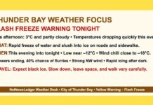
As of 7:00 AM EDT, it’s mainly clear over Thunder Bay with a crisp temperature of -12.2°C at the airport. With a light west-northwest wind at 5 km/h, it feels like -15°C thanks to the wind chill. Humidity is 82%, and the barometric pressure is 102.2 kPa and rising, signaling one last calm day before the skies open up.
Tuesday’s weather is relatively tame—sunny with a high of +1°C, though morning wind chills of -19°C will keep the morning commute brisk. Winds stay light, and the UV index sits at a moderate 4 for those looking to soak up some sunlight before tomorrow’s snow squall begins.
Wednesday: Snow, Wind, and Zero Visibility
Wednesday will be the main event, with snow moving in during the early morning hours and becoming heavy by the afternoon. The city is expected to see 20 cm by day’s end, with peak snowfall rates of 3 to 5 cm per hour. Add in easterly winds gusting up to 70 km/h, and we’ve got a recipe for whiteout conditions—particularly in open areas downwind of Lake Superior, where blowing snow will wreak havoc on visibility.
Temperatures will struggle to hit -1°C, and with the wind howling, the wind chill will stay near -9°C throughout the day.
Wednesday night keeps the snow going, though the winds are expected to ease overnight. The low will dip to -4°C, and snow will taper to flurries by early Thursday morning.
Thursday and Friday: Bright Spots and Flurry Chances
By Thursday, the worst of the storm will have passed, but there’s still a 60% chance of lingering flurries under a mix of sun and cloud. Temperatures will rebound to a milder high of +7°C, helping to start the melt.
Thursday night clears out with a low of -7°C, setting up a quieter Friday. The forecast calls for cloudy skies and a high of +5°C, giving folks a break from the snow shovel. Friday night holds on to some cloudy periods, with a low of -5°C and a slight chance of more flurries.
Historical Weather Snapshot: April’s Not-So-Foolish Storms
Thunder Bay’s April 1st weather history proves this kind of storm isn’t totally out of character. The city has recorded highs as warm as 18.3°C and lows as cold as -27.4°C. So while 30 cm of snow in April may seem dramatic, it’s not exactly unprecedented—just inconvenient (and a little unfair).
What to Wear: Today’s Light Layers, Tomorrow’s Blizzard Armor
Today’s sunshine invites a light winter jacket, mitts, and maybe even sunglasses. But by tomorrow, it’s full storm gear: snow boots, thermal layers, windproof outerwear, and something to cover your face from the icy gusts. Drivers, take note—Wednesday is a day to work from home if you can. If you must head out, pack extra warm clothes, a charged phone, and snacks. You know, just in case your “quick trip” turns into a winter camping adventure.
Weather Trivia: Thunder Bay’s Stormy Lake Effect
Thunder Bay’s location near Lake Superior makes it a magnet for wild winter weather—even in April. Lake-enhanced snow, when combined with strong easterly winds, can create sudden squalls and intense accumulation, even when spring is knocking on the door. So, if you’re wondering why you’re shoveling instead of gardening this week—blame the lake.


