Chilly Start, Bright Finish – Thunder Bay’s Spring Weather Keeps You Guessing
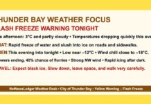
Thunder Bay, ON – Monday, March 31, 2025 – It’s a frosty farewell to March in Thunder Bay, where the morning began with cloudy skies and a brisk -5.7°C at 6:00 AM. The wind from the north-northwest at 15 km/h is making things feel closer to -11°C, while humidity sits at a bone-dry 37%.
Visibility remains excellent at 24 km, and the barometric pressure is on the rise at 101.5 kPa—hinting at some temporary stability in the atmosphere.
Don’t let the calm fool you, though—this week’s forecast still has a few weather curveballs up its sleeve.
Today’s Forecast – Skies Clear, But the Wind Has Other Plans
Skies are expected to clear this morning, giving way to sunshine and blue skies by midday. But the winds? They’re just getting started. Expect northwest winds to pick up to 20 km/h, gusting up to 40 by late morning. With a wind chill of -17°C to start the day, it’ll take a few hours before things begin to feel remotely springlike.
The temperature will rise to a modest +1°C by this afternoon, offering a little thaw. Still, with the dry air and wind, that warmth will be more psychological than physical. The UV index comes in at a moderate 3, so if you’re out enjoying the sunshine, a dab of sunscreen won’t go amiss.
Tonight and the Days Ahead – Cold Nights and a Midweek Snow Surprise
Tonight will be mostly clear, but clear skies come at a price. Temperatures will plunge to -14°C with wind chills making it feel more like -16 overnight. Winds will ease to calm later in the evening, but the chill will hang on stubbornly.
April kicks off Tuesday with sunshine in the morning, transitioning to a mix of sun and cloud by afternoon.
Temperatures will climb back to +1°C, though morning wind chills will be as low as -20. East winds will pick up to 20 km/h in the afternoon, and the UV index will rise to a moderate 4.
Clouds return Tuesday night with a low of -6°C, setting the stage for Wednesday’s return to winter. Expect snow throughout the day with windy conditions and a high of -1°C. Snow continues overnight into Thursday, when flurries remain likely with a high of +2°C. Thursday night cools off once again to -8°C.
Wardrobe Suggestion
Today’s wardrobe plan: layers, windproofing, and something to keep the chill from gnawing at your ears. If you’re venturing out early, bundle up like it’s still January. That morning wind chill is sneaky and sharp. Don’t forget gloves—fingers aren’t fans of -17°C mornings.
This Day in Thunder Bay Weather History
Thunder Bay has seen a wild range of temperatures on March 31 over the years. The record high for this date is 13.8°C, set in 1986—a distant dream today. The record low? A biting -28.3°C in 1964. While this morning’s chill isn’t record-breaking, it’s still a reminder that spring in the north arrives on its own terms.
Did You Know?
Thunder Bay’s unique spot along the northern edge of Lake Superior means the city often sees colder temperatures linger longer than other parts of southern Ontario. The lake may be massive, but in spring it acts more like an icebox than a heater—especially when those northwest winds sweep across it.


