Special Weather Statement in Effect as Winter Storm Targets Kenora Region
Kenora braces for a spring snowstorm with up to 20 cm of snow, freezing rain risks near the border, and difficult travel expected Friday into Saturday
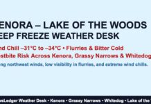
KENORA, ON – March 27, 2025 – Residents in Kenora and the Lake of the Woods region, including Grassy Narrows and Whitedog, should brace for a spring storm that’s more “January” than “March.” A Special Weather Statement is in effect with 10 to 20 cm of snow expected, starting Thursday night through Friday night, with a risk of freezing rain and ice pellets near the international border. Whether you’re heading out on the roads or just trying to get your car door open, Friday’s shaping up to be a snowy slog.
Thursday’s Weather – A Calm Before the Flake-Filled Frenzy
As of 4:00 AM CDT, Kenora Airport is reporting partly cloudy skies and a temperature of -4.6°C, with a wind chill making it feel more like -10°C. Winds are out of the north at 17 km/h, humidity is 77%, and pressure is 102.1 kPa and rising — a brief moment of stability before the pressure drops and the storm moves in.
Today offers a mix of sun and cloud with just a 30% chance of flurries early this morning. Winds will ease up to 15 km/h by afternoon, and the high should nudge up to zero, though this morning’s wind chill of -13°C means it’ll be a while before it feels remotely mild. The UV index is a manageable 3, so glare off the snow shouldn’t be too harsh.
Friday Snowstorm Alert – Visibility Drops, Roads Get Rough
Tonight, snow begins in earnest, with 5 cm expected overnight. Winds pick up from the northeast at 20 km/h, and temperatures will fall to -5°C, with a wind chill around -12°C.
Friday is the main event, as snow, at times heavy, blankets the region with an additional 10 to 15 cm. That brings the two-day total close to the 20 cm mark, with even higher amounts possible in areas not affected by ice pellets or freezing rain. Visibility will be significantly reduced in bursts of heavy snow, and travel could become hazardous, especially if the icy mix near the U.S. border moves north.
Winds will stay brisk from the northeast at 20 km/h, gusting to 40. The high will be -1°C, with wind chills of -12°C in the morning and -7°C in the afternoon. Not the kind of Friday where you’ll want to be brushing off the driveway in slippers.
Friday night will keep the snow going with periods of flurries and a low of -8°C, giving snowplow drivers an extra-long shift.
Weekend Outlook – A Little Relief, Then Arctic Cold at Night
Saturday will be a little quieter with cloudy skies and a 40% chance of flurries, plus a high just above freezing at +1°C. But don’t let your guard down — Saturday night clears out and the mercury drops fast to -12°C.
Sunday looks much brighter with sunshine all day and a high near zero. Sunday night stays clear and cold, with a low of -13°C. Monday continues the sunny streak with a high of +1°C, and cloudy periods return Monday night, but it’ll still be brisk, dropping to -9°C.
Bundle Up and Prep the Shovel – It’s a Classic Kenora Snowstorm
This spring storm will be textbook Northwestern Ontario: lots of snow, blowing winds, possible freezing rain near the border, and temperatures cold enough to keep everything nicely frozen. It’s the kind of setup that demands full winter gear — parkas, toques, insulated boots, and mitts you can still grip a snow shovel with.
Travel on Friday should be avoided where possible, especially during the day when snowfall rates may be high. Those in more southern areas of the region should stay alert for changing precipitation types, which could turn slick quickly.
Kenora’s Wild Weather Legacy
On this day, Kenora’s record high was 12.5°C in 1986, while the record low hit a bitter -28.2°C back in 1965. While we’re not breaking records this week, 20 cm of snow in late March is far from unusual for this region — and it serves as a yearly reminder that winter always gets the last word in Northwestern Ontario.
Fun fact: The Lake of the Woods often acts as a moisture source that enhances local snowfall in this region — meaning Kenora’s snow days can be even snowier than forecast, especially when systems roll in from the Prairies.

