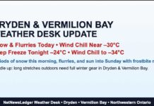
A Deep Freeze Kicks Off the Day with a Frosty Wind Chill
Dryden and Vermilion Bay wake up to frigid wind chills near -32°C today. A slow warm-up arrives by Sunday, with snow and temps hitting +1°C.
It’s another bitterly cold morning in Dryden and Vermilion Bay, with temperatures sitting at -22.9°C as of 6:00 AM at the airport. The wind from the west-northwest at 13 km/h is driving the wind chill down to a frigid -32°C, making for an icy start to the day. Humidity is at 74%, and the barometric pressure is 103.8 kPa, holding steady as clear skies dominate.
Today’s Forecast: Sunshine, But No Heat
Despite sunny skies, winter is still in full force. Winds will stay light at up to 15 km/h, but that’s enough to make the morning wind chill feel like -30°C. By the afternoon, things improve slightly, with a high of -10°C and a wind chill of -13°C, but it’s still cold enough to require serious layering. The UV index is low at 2, though glare off the snow might make sunglasses a good idea.
Tonight: Cold and Clear Before Clouds Roll In
Skies will stay clear through the evening, but partly cloudy conditions develop after midnight. Winds remain light at up to 15 km/h, and the temperature drops to -20°C. The wind chill will make it feel like -15°C this evening and -27°C overnight, bringing a continued risk of frostbite.
Looking Ahead: Gradual Warm-Up, But Snow on the Horizon
- Friday, February 21: Mainly cloudy, with a 40% chance of flurries late in the afternoon. Winds remain light at up to 15 km/h. The high reaches -8°C, but the morning wind chill will be -25°C, easing to -14°C in the afternoon.
- Friday Night: Cloudy with a 40% chance of flurries, low of -14°C.
- Saturday, February 22: Cloudy with a 30% chance of flurries, high of -4°C—finally a little less frigid!
- Saturday Night: Cloudy with a 40% chance of flurries, low of -9°C.
- Sunday, February 23: Cloudy with a 60% chance of snow, and for the first time in a while, temperatures rise above freezing, hitting +1°C!
- Sunday Night: Periods of snow continue, low of -2°C.
What to Wear: Arctic-Grade Layers Required
With wind chills in the -30s this morning, frostbite can develop in minutes, so dress accordingly. That means a heavy winter coat, insulated gloves, a toque, a scarf, and thermal layers. If you’re heading outdoors, cover all exposed skin, and consider double socks and windproof boots to keep those toes warm.
Dryden Weather Trivia: How Cold Can It Get?
Think today’s chill is bad? Back on February 3, 1996, Dryden set a record low of -45.6°C! That makes today’s -32°C wind chill seem almost mild in comparison—though I doubt anyone outside would agree.


