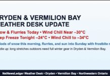
Frigid Start with Gusty Winds and a Chance of Flurries
Dryden and Vermilion Bay face extreme cold today, with wind chills near -30°C and frostbite risks. Bitter cold continues Tuesday, with some sun breaking through
Residents of Dryden and Vermilion Bay are waking up to a brutally cold Monday morning, with the temperature sitting at -20.2°C as of 4:00 AM. The wind, blowing from the west-southwest at 15 km/h, is making it feel much colder, with a wind chill of -29°C. Humidity is at 82%, and visibility remains decent at 16 km. The barometric pressure is at 101.9 kPa, suggesting stable but chilly conditions ahead.
Today’s forecast calls for mainly cloudy skies with a 30% chance of flurries drifting in throughout the day. Winds will pick up, shifting west and increasing to 20 km/h, gusting up to 40 km/h this morning. Despite a projected high of -15°C, the wind chill will make it feel like -29°C this morning and -24°C this afternoon. Frostbite is a significant risk, meaning exposed skin can freeze within minutes. The UV index will remain at a low 1—not that anyone is thinking about sunscreen in this weather.
Tonight: Even Colder with Wind Chills Dropping Below -30°C
Mainly cloudy conditions will continue into the evening, with a lingering 30% chance of flurries. The west wind will remain at 20 km/h, gusting to 40 km/h, before easing up overnight. Temperatures will plummet to -24°C, with the wind chill making it feel like -26°C this evening and a brutally cold -32°C overnight. Frostbite risks remain high, so bundling up is essential for anyone venturing outdoors.
Tuesday: Sun Peeks Through, but the Cold Holds On
Tuesday will bring a mix of sun and cloud, with lighter winds up to 15 km/h. However, that won’t provide much comfort, as the temperature will stay locked in at -16°C. The wind chill in the morning will be an unforgiving -34°C before “warming” to -22°C in the afternoon. Once again, frostbite remains a major concern. The UV index stays low at 1.
Tuesday night will see cloudy periods with a low of -21°C.
Wednesday: Flurries Likely as Temperatures Slightly Improve
By midweek, the deep freeze lets up just a little. Wednesday will be cloudy with a 60% chance of flurries and a slightly “warmer” high of -11°C. The night will stay cloudy, with another 60% chance of flurries and a low of -18°C.
What to Wear?
This kind of cold is no joke—layering is critical. A thick winter coat, thermal base layers, insulated boots, and warm mittens are essential. A hat and scarf are non-negotiable, and any exposed skin should be covered to prevent frostbite. Wind chills below -30°C mean frostbite can develop in under 10 minutes, so dress smart and limit time outdoors.
Dryden and Vermilion Bay Weather Trivia
Did you know? The coldest February 3rd on record for Dryden was a bone-chilling -41.1°C in 1996. So, while today feels icy, history reminds us that it could be much worse. On the flip side, the warmest February 3rd recorded was 2.3°C in 1991—practically tropical compared to today’s forecast!


