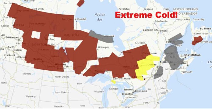
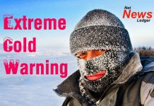
Extreme Cold Warning for Northwestern Ontario: Wind chills as low as -41°C and frostbite risks in minutes. Stay safe as Arctic air brings frigid temperatures all weekend
Extreme Cold Warning Grips Northwestern Ontario: Bundle Up or Stay In
Northwestern Ontario is bracing for a bitter blast of Arctic air as an Extreme Cold Warning blankets the region. Temperatures are plummeting to life-threatening lows, with wind chills making it feel even colder than it already is. If you thought winter was being harsh before, this latest cold snap is here to remind you that January isn’t done flexing its icy muscles just yet. Whether you’re in Thunder Bay, Kenora, Dryden, or Red Lake, staying warm and safe is the priority this weekend. Let’s break down what’s ahead.
Thunder Bay: Arctic Air Tightens Its Grip
In Thunder Bay, temperatures are struggling to rise past -16°C today. Wind chills make it feel more like -29 this morning, and tonight it gets even colder, dropping to -28°C with a wind chill near -39°C. Frostbite can occur in just minutes, so ensure any outdoor activities are brief and that exposed skin is well-covered.
Tomorrow (Sunday), sunshine does little to help, with highs of -21°C and wind chills hovering between -39°C in the morning and -30°C in the afternoon. The extreme cold remains a threat into Monday, with a low of -32°C expected overnight.
Kenora and Lake of the Woods: Frostbite in Minutes
In Kenora, temperatures are currently at -26°C, with light snow and drifting snow causing visibility issues this morning. Wind chills make it feel like a frigid -39°C. The snow will clear for mainly sunny skies, but the high will only reach -23°C, with wind chills sticking near -34°C in the afternoon.
Tonight, the mercury drops to -30°C, with a wind chill that feels like a staggering -41°C. Tomorrow, there’s a chance of afternoon flurries, but temperatures remain brutally low, with a high of -23°C and morning wind chills at -41°C.
Dryden and Sioux Lookout: Winter’s Grip Tightens
Dryden and Sioux Lookout are also feeling the sting of Arctic air. Current conditions hover around -25°C, with wind chills making it feel closer to -40°C. The high today will hit -24°C, but the dangerous wind chills will persist, making frostbite a concern. Tonight, lows plummet to -30°C with wind chills nearing -41°C.
Sunday brings a mix of sun and cloud, but it’s another day to stay bundled. Highs remain near -23°C, with wind chills starting at -41°C in the morning and “warming up” to -33°C in the afternoon.
Red Lake and Big Trout Lake: Deep Freeze Intensifies
The Red Lake and Big Trout Lake areas are deep in the Arctic freeze. Current conditions are hovering near -26°C, with wind chills making it feel more like -39°C to -41°C. These dangerous wind chills will persist all weekend, with overnight lows dropping to the -30s and daytime highs struggling to climb past -23°C.
Monday offers little relief as the Arctic grip continues with bitterly cold temperatures and dangerous frostbite risks.
Frostbite Risk: Know the Signs
With Extreme Cold Warnings in effect across Northwestern Ontario, frostbite is a real and immediate risk. When wind chills drop below -30°C, exposed skin can freeze in as little as 5 to 10 minutes. Protect yourself by covering all exposed skin, wearing multiple layers, and limiting outdoor time as much as possible. Signs of frostbite include numbness, white or grayish skin, and a hard or waxy feel to affected areas. If you suspect frostbite, seek warmth immediately and consult a healthcare professional.
Historic Temperatures: January’s Cold Legacy
This region is no stranger to extreme cold. Thunder Bay’s record low for January 18th was a teeth-chattering -36.7°C, while Kenora hit -41.0°C on this date in years past. It’s clear that January in Northwestern Ontario has always had a reputation for being brutally cold, and this weekend is no exception.
Wardrobe Wisdom: How to Dress for Arctic Conditions
Dressing for this kind of cold isn’t just about comfort – it’s about survival. Layering is key: start with thermal base layers, add insulating sweaters, and finish with a heavy-duty parka. Protect extremities with a windproof hat, scarf, gloves, and insulated boots. This is not the time to skip the scarf or forget your mittens – frostbite is no joke.
Weather Trivia: Why So Cold?
Ever wonder why it gets this cold? Northwestern Ontario is no stranger to Arctic outbreaks, which happen when frigid air masses from the polar regions are pushed south by strong high-pressure systems. Combine that with clear skies overnight, which allow heat to escape into the atmosphere, and you have a recipe for bone-chilling temperatures.


