NORTHWEST REGION – As of August 3, 2024, four new wildland fires were confirmed in the Northwest Region during the evening of August 2, with an additional two fires confirmed by early evening on August 3. This brings the total number of active fires in the region to 33, with varying levels of containment.
Current Fire Activity:
- Nipigon 26 (NIP026): This fire, covering 80.0 hectares, is located about 24.5 kilometers east-northeast of Lastcedar Lake in Webequie First Nation and 15.0 kilometers northeast of Plant Lake. It is currently being observed.
- Sioux Lookout 26 (SLK026): This 60.0-hectare fire is situated 0.7 kilometers east of Bearskin Lake and 38.7 kilometers southwest of Bearskin Lake First Nation. It is also being observed.
- Sioux Lookout 27 (SLK027): Located approximately 29.2 kilometers north of Wunnummin Lake and 24.4 kilometers south of Wawakapewin First Nation, this 30.0-hectare fire is under observation.
- Red Lake 26 (RED026): Positioned on an island in Old Shoes Lake, 11.4 kilometers north of Poplar Hill First Nation, this 1.4-hectare fire is currently being held.
- Red Lake 27 (RED027): This small 0.5-hectare fire is located 23.0 kilometers east of the Manitoba border and 20.3 kilometers northwest of the western shore of Deer Lake. It is not under control.
- Red Lake 28 (RED028): Covering 0.2 hectares, this fire is situated 20.0 kilometers south of MacDowell Lake and 29.3 kilometers northeast of Goose Lake. It is also not under control.
Out of the 33 active fires in the Northwest Region, 2 are under control, 3 are being held, 6 are not under control, and the rest are being observed.
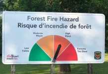
The fire hazard across the Northwest Region ranges from low to extreme. The majority of the region is experiencing moderate to high fire hazards, with low hazard levels in the southwest corner, covering much of the Fort Frances and Kenora sectors, and the northern reaches of the Sioux Lookout sector. However, pockets of extreme hazard are present in the Red Lake sector and the northern half of the Greenstone sector.
For the latest updates on active fires and fire hazards in your area, visit our Interactive Map.
Outdoor Burning Regulations:
Aviation, Forest Fire, and Emergency Services remind the public to exercise caution when performing outdoor burning. Consider composting or using your local landfill for yard waste and woody debris. If burning is necessary, follow Ontario’s Outdoor Burning Regulations.
- Fires should be ignited no earlier than two hours before sunset and extinguished no later than two hours after sunrise.
- Ensure you have adequate tools and water to control the fire at the site.
- Familiarize yourself with the full set of Outdoor Burning Regulations.
Waterbomber Safety:
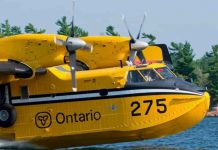
If you encounter waterbombers approaching a body of water, move your watercraft close to shore to allow them to scoop water safely. Waterbombers will not scoop from a lake or river if watercraft pose a safety risk.
Report a Wildland Fire:
- North of the French and Mattawa Rivers: Dial 310-FIRE to report a wildfire.
- South of the French and Mattawa Rivers: Dial 9-1-1 to report a wildfire.

