THUNDER BAY – WEATHER – What is with the weather anyhow? Over December in Thunder Bay it was above normal temperatures and those warm temperatures meant a record warm December.
Now it appears, at least for now that Winter has returned again.
Lets look at the weather patterns expected over the rest of January:
Despite the official start of winter on December 21, most of Canada has experienced a notably mild winter so far, with November and early December feeling more like late fall.
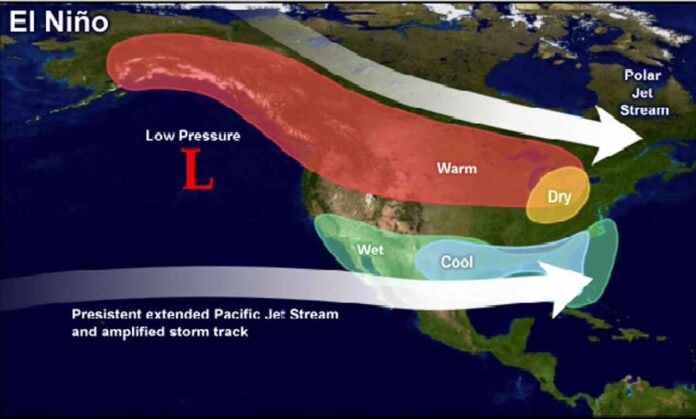
The reason behind this unusual warmth is a strong El Niño, which has kept consistent normal winter weather at bay.
However, changes are on the horizon.
A significant alteration in the jet stream pattern is underway, primarily driven by the anticipated split of the polar vortex. This split is expected to position one part of the vortex over Northern Canada, significantly influencing the weather through mid-January.
Recent weather maps have started showing colder-than-normal temperatures emerging over the Arctic, creeping into the Yukon and the Northwest Territories. These regions, unusually mild in December, are now beginning to experience the onset of frigid weather.
As January progresses, especially in its second week, this Arctic air is forecasted to sweep south across Western and Central Canada and into the United States. Despite this being the coldest time of the year, the presence of above-normal temperatures could still lead to heavy snow and ice. The forecast indicates a very active storm track from the Great Lakes to Atlantic Canada during the second and third weeks of January.
Mid-January may see this Arctic air shift eastward, affecting Ontario and Quebec for several days. Following this, a more typical mid-winter pattern is expected to take hold across most of Canada. This pattern will bring intermittent frigid weather, but a temporary relaxation later in the month might allow for milder temperatures — a traditional January thaw — before the return of colder conditions.


