THUNDER BAY – WILDFIRE UPDATE – As of this update, the Northwest Region is grappling with 39 active fires. Among these fires, five are still not under control, two are being held, three are under control, and 29 fires are being closely observed, necessitating continuous monitoring and assessment by firefighting teams.
New Fire Confirmed
One new fire was confirmed in the Northwest Region during the late afternoon of July 19. Sioux Lookout 78, situated approximately 31.0 kilometers east of Sioux Lookout and 5.3 kilometers northwest of Burnt Dam Lake, emerged as a concern. However, thanks to swift response efforts, the fire was contained and extinguished early this afternoon. It spanned a small area of only 0.1 hectares.
Fire Hazard Conditions
The Northwest Region currently experiences mainly low fire hazard levels, providing some relief. However, scattered pockets of moderate hazard remain in certain sectors, including Red Lake, Fort Frances, Thunder Bay, and Greenstone. Vigilance and precautionary measures are crucial in these areas.
Fires of Note
Several notable fires continue to pose challenges in the Northwest Region:
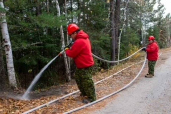
- Sioux Lookout 33, located on the western edge of Wabakimi Provincial Park, spans a vast area of 60,394 hectares. Unfortunately, this fire remains uncontrolled, necessitating ongoing efforts to establish hose lines and provide support through helicopter bucketing operations.
- Sioux Lookout 44, situated on the west side of Lake St. Joseph, is currently being held at a size of 6,730 hectares. Firefighters are actively establishing hose lines in priority areas of the fire, while infrared scanning helps identify hotspots.
- Nipigon 19, northwest of Ogoki Lake, covers an extensive area of 10,182 hectares and remains uncontrolled. Firefighters are making commendable progress by establishing hose lines and working alongside helicopter bucket machines to contain the fire’s spread. Infrared scanning assists in identifying hotspots along the fire’s perimeter.
- Red Lake 28, located 40 kilometers north of Lac Seul First Nation, poses a significant challenge as it spans an area of 19,177 hectares. Firefighters continue their efforts to establish hose lines and provide support through helicopter bucketing operations. Infrared scanning aids in identifying hotspots along the fire’s perimeter, enabling targeted response strategies.
Safety Reminders
- Stay Clear of Waterbombers
- When waterbombers approach a body of water, move closer to the shore to ensure their safe scooping. It’s essential to maintain a safe distance as waterbombers will not scoop from a lake or river if watercraft in the vicinity pose a safety hazard.
- No Drone Zone
- Flying drones around forest fires is both dangerous and illegal. Drone activities near forest fires put the lives of pilots, firefighters, and emergency personnel at risk. Ensure safety by refraining from flying drones near forest fire areas.
Report a Wildland Fire
To report a wildland fire located north of the French and Mattawa rivers, dial 310-FIRE. For forest fires situated south of the French or Mattawa rivers, immediately dial 911 to report the incident and facilitate swift response from authorities. Your cooperation and prompt reporting are vital in containing fires and ensuring the safety of all.

