Aviation, Forest Fire and Emergency Services: Northwest District Update
THUNDER BAY – Wildfire Update – The Northwest Region continues to battle wildfires as one new fire was confirmed on June 18. Fort Frances 11, situated near Below Bow Lake, approximately 28 kilometers north of Atikokan, spans an area of 0.2 hectares and is currently being held, thanks to ongoing firefighting efforts.
Active Fires and Notable Incidents
As of this update, the Northwest Region is contending with a total of 33 active fires. Of these, eight fires remain uncontrolled, three are being held, five are under control, and 17 are being observed. Notable fires in the region include Sioux Lookout 7, covering an extensive area of 16,002.79 hectares, located north of Cat Lake First Nation. While hose lines have been established on the southern end, the northern section is closely monitored as the fire remains uncontrolled. Similarly, Nipigon 13, spanning 3,077.3 hectares west of Ogoki Lake, requires ongoing values assessment and protection measures.
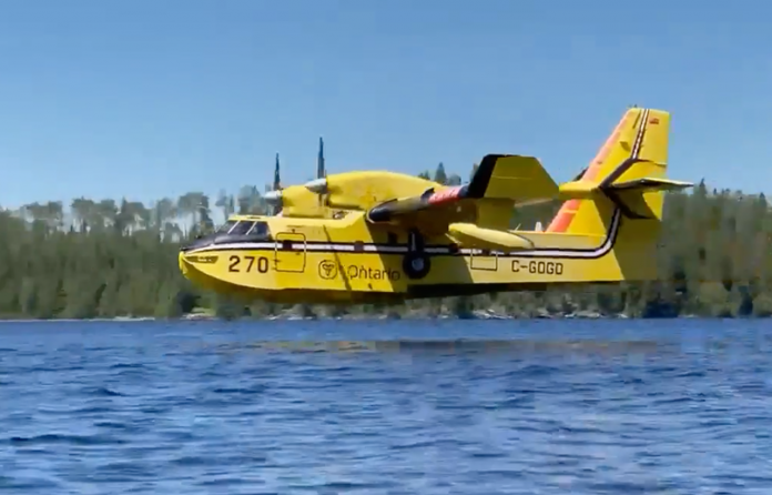
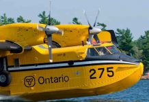
Nipigon 19, northwest of Ogoki Lake, covers 444 hectares and remains uncontrolled, with efforts focused on establishing hose lines and utilizing helicopter bucketing operations, heavy equipment, and waterbombers for support.
Red Lake 28, situated 50 kilometers north of Lac Seul First Nation, spans 4,238.65 hectares and is not yet under control, while Red Lake 32, covering 387.8 hectares on an island 20 kilometers west of Poplar Hill First Nation, is being observed and evaluated for potential controlled ignition to natural boundaries.
Northwest Fires of Note:
-
- Sioux Lookout 7 is located north of Cat Lake First Nation and is 16,002.79 hectares in size. Hose lines have been established on the southern end of the fire while the northern section is being monitored. The fire remains not under control.
- Nipigon 13 is located west of Ogoki Lake and is 3,077.3 hectares in size and not under control. Values assessment and protection in ongoing in the area.
- Nipigon 19 is located northwest of Ogoki Lake and is 444 hectares in size and not under control. Crews continue to establish hose lines while helicopter bucketing operations and heavy equipment provide support. Waterbombers also provided support yesterday.
- Red Lake 28 is located 50 kilometers north of Lac Seul First Nation and is 4,238.65 hectares in size and not under control. Values assessment and protection are ongoing.
- Red Lake 32 is located 20 kilometers West of Poplar Hill First Nation and is 387.8 hectares in size. The fire is being observed and is located on an island. Ignition opportunities continue to be evaluated to bring the fires edge to natural boundaries.
Fire Hazard Conditions and Safety Measures
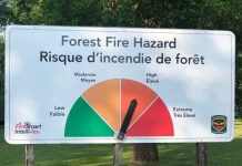
The fire hazard remains high to extreme in several areas, including Dryden, Fort Frances, Thunder Bay, Nipigon, and eastern portions of the Sioux Lookout sector. However, recent rainfall has led to moderate to low hazard conditions in Kenora, Red Lake, and northwest portions of the Sioux Lookout sector. The Northwest Region as a whole still faces a high to extreme fire hazard. To stay updated on fire hazard conditions in specific areas and gain an overview of regional fires, residents are encouraged to refer to the Interactive Map provided.
Restricted Fire Zone and Safety Regulations
To mitigate the extreme forest fire hazard, the Ministry of Natural Resources and Forestry has implemented a Restricted Fire Zone for the entire fire region of Ontario (Zones 1 to 36). This zone remains in effect until further notice and serves as a crucial measure to protect public safety. Within the boundaries of the Restricted Fire Zone, all open air burning, including campfires, is strictly prohibited. However, portable gas or propane stoves may be used for cooking and warmth, emphasizing the need for extreme caution. It is important to note that all burning permits have been suspended during this time.
For a comprehensive understanding of the areas affected by the Restricted Fire Zone, readers can access the provided link to the map.
Reporting Wildland Fires
Residents are reminded to promptly report any wildland fires located north of the French and Mattawa rivers by dialing 310-FIRE. For forest fires located south of these rivers, please dial 911.

