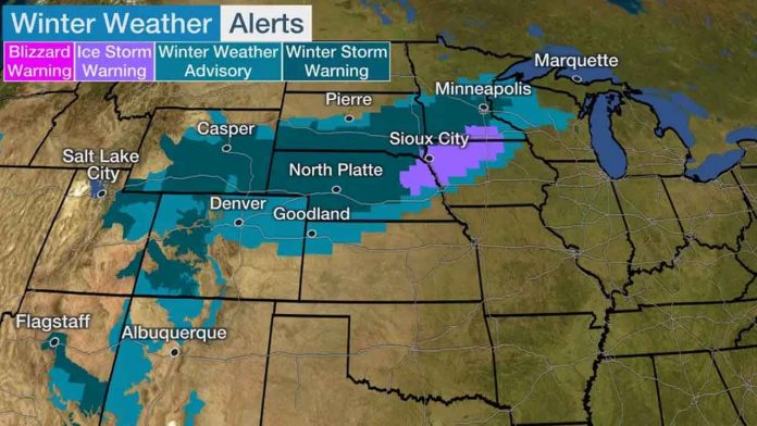
Winter storm warnings and winter weather advisories have been issued by the United States National Weather Service, for states stretching from the Rockies into the upper Mississippi valley.
The worst travel conditions will generally be in areas under winter storm warnings, including Minneapolis-St. Paul.
An ice storm warning is also in effect from northeast Nebraska into northwest Iowa and south-central Minnesota. This is where there is a heightened risk of icing that could be heavy enough cause tree damage and knock out power.
Monday and Monday night, we expect snow to continue in Colorado and Wyoming and spread into parts of western and northern Nebraska and South Dakota, as well as central and southern Minnesota. Strong winds will be on the increase as well, contributing to blowing snow and low visibility in some areas.
There could be a narrow band of freezing rain or sleet on the southern periphery of this area of snowfall from the Central Plains into the upper Mississippi Valley. This area may include Sioux City, Iowa, and Rochester, Minnesota. There is some potential for power outages and tree damage.

