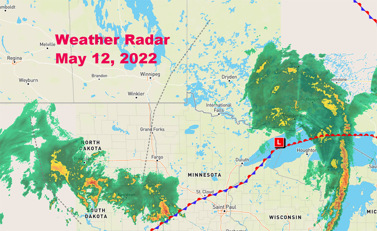
THUNDER BAY – WEATHER – There are weather warnings and special weather statements out right across Western Ontario. The Rainfall Warnings issued by Environment Canada on Wednesday afternoon have proven accurate.
For the Thunder Bay region there is a Flood Watch Advisory issued by the Lakehead Region Conservation Authority.

Kenora, Dryden – Vermilion Bay, – Fort Frances, Atikokan, Ignace, Sioux Lookout, English River, Kakabeka Falls, and the City of Thunder Bay are all under Rainfall Warnings.
Thunder Bay
The City of Thunder Bay remains under a rainfall warning.
It is a warmer but wet +10 this morning with light rain. The high for Thursday will be +19. Showers should end this morning, but there is a risk of a thunderstorm. Winds are fairly light this morning.
UV Index 5 or Moderate.
For this evening, skies will remain cloudy, with a 30 per cent possibility of precipitation. That will change to a 70 per cent potential near midnight. There will be a risk of a thunderstorm. The low overnight will be 7.
Rainfall warning in effect for:
- City of Thunder Bay
Rain, heavy at times is expected. The ground, already near saturation, has little ability to absorb further rainfall. Total rainfall amounts of 30 to 50 mm are expected with higher local rainfall amounts possible in thunderstorms.
Fort Frances
It is 12 in Fort Frances this morning under a rainfall warning. Showers will be ending this morning followed by cloudy skies. Rain will will be starting this afternoon, along with the risk of a thunderstorm. Winds will be from the east at 20 gusting to 40 km /h late this afternoon.
Two rounds of showers and thunderstorms are expected. The first round will taper off this morning. The second is forecast to begin this evening and taper off Friday morning.
UV index will be 7 or High.
This evening showers will be ending before morning and then skies will remain mainly cloudy. There is a risk of a thunderstorm. Rainfall amounts will be 15 to 25 mm. Winds will be from the east at 30 km/h with gusting winds up to 50 km/h. Low overnight will be 16.
Rainfall warning in effect for:
- Fort Frances – Emo – Rainy River
- Seine River Village – Mine Centre
Rain, heavy at times is expected. The ground, already near saturation, has little ability to absorb further rainfall.
Hazard: Total rainfall amounts of 30 to 50 mm. Higher local rainfall amounts are possible in thunderstorms.
Timing: This morning and tonight.
Dryden and Vermilion Bay
Dryden and Vermilion Bay are under a rainfall warning. Rainfall showers will be ending this morning, followed by cloudy conditions. There will be a few showers this afternoon, along with the risk of a thunderstorm. Winds will be from the east at 20 km/h gusting to 40 km/h this afternoon.
Two rounds of showers and thunderstorms are expected. The first round will taper off this morning. The second is forecast to begin this evening and taper off Friday morning.
The UV index will be 7 or high.
For Thursday night, there will be a few showers ending before morning followed by cloudy skies. There will be a risk of a thunderstorm. Total rainfall amounts of 20 to 30 mm. Winds will be from the east gusting up to 60 km/h but will be diminishing to 20 gusting to 40 km/h. The overnight low will be 11.
Rainfall warning in effect for:
- Dryden – Vermilion Bay
- Ignace – English River
Rain, heavy at times is expected. The ground, already near saturation, has little ability to absorb further rainfall.
Hazard: Total rainfall amounts of 30 to 50 mm.
Higher local rainfall amounts are possible in thunderstorms.
Sachigo Lake
It is 5 in Sachigo Lake this morning headed to a high of 20. Skies will be a mix of sun and clouds.
The UV index will be 8 or Very High.
Tonight will see increasing clouds with winds becoming east at 30 km/h gusting to 50 km/h. Low will be +5.


