THUNDER BAY – NEWS – Thunder Bay is currently working to address and monitor city-wide flooding risks, following the Flood Watch Warning issued by the Lakehead Region Conservation Authority.
In addition to the road closures, sections of the following roads are experiencing significant flooding and should be avoided if possible:Coppin Road, Chippewa Road, Broadway Avenue, Rosslyn Road, Mountain Road, Loch Lomond Road, Little Norway Road, Hazelwood Drive and Gorevale Road. Access to homes in these areas may become impacted. Residents are encouraged to plan accordingly.
The City is reminding residents to exercise caution in and around area waterways. Drivers are asked to proceed with caution on roads with higher water levels, as the adjacent ditch may not be visible and is a hazard.
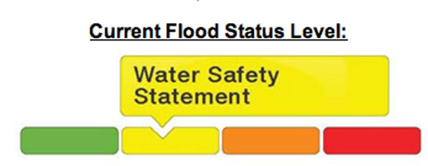
The Lakehead Region Conservation Authority has issued a Flood Warning.
The flooding situation has led to closures across the city on sections of the following roads: 15th Side Road, Trendiak Road, Law Road, Community Hall Road, Gus Wuori Road, Burns Road, Melbourne Road, and Ada Avenue. Access to homes in these areas is impacted. Those unable to access their homes will be required to seek alternate accommodations. Those currently in their homes in these areas should stay in their homes if possible. In case of emergency, call 911.
The flooding situation is changing very quickly and the City will continue to monitor and respond accordingly. There may be roads in and around the City not listed, that may be experiencing ponding and flooding. Any roads covered with water should be avoided and drivers should seek alternate routes. Rural areas should be aware of road conditions and plan accordingly.
Flooding along sections of multi-use trails has also occurred in various locations across the city, some of which have been barricaded including the underpasses at James Street and Edward Street.
The trails in Centennial Park, on the West and South sides of the Current River, will be temporarily closed due to flooding on the trails and the high water level of the Current River. This closure is necessary both for the safety of trail users and to minimize damage to the trail surface.
Trail users are asked to respect the closure barricades and to be aware of the potential for flooding. Users should not be accessing or crossing flooded portions of the trail network. Trail monitoring will continue over the coming days.
All City waterways are still being closely monitored. Once rivers and creeks recede, Infrastructure & Operations will commence any necessary road and trail repairs.
The City’s Municipal Emergency Control Group (MECG) met today to plan for the heavy rain in the forecast.
For more information, or to report a problem, contact the Infrastructure & Operations Dispatch at 625-2195 or publicworks@thunderbay.ca


