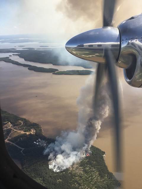
KASHECHEWAN – NEWS – “I am very concerned of the risk assessment factors that led to a decision to evacuate the vulnerable population to the southern community; however, it is necessary for the safety and well-being of the community. A joint risk assessment process suggests there is a high potential of flooding which could endanger the lives of the remaining community members who are not able to evacuate to the trapline/hunting grounds as per the OTL Initiative,” states Chief Gaius Wesley.
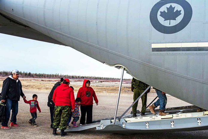
After a risk assessment review of the high-risk potential flooding of the Albany River, the Kashechewan First Nation (KFN) will proceed with the precautionary evacuation of the vulnerable population.
Kashechewan First Nation is prone to flooding each spring.
The First Nation declared a State of Emergency on April 13, 2022.
Since then, there have been numerous meetings with the Joint Command Table (JCT) consisting of regional, provincial, and federal partners. The JCT evaluate the risk assessment of flooding prior to making a collective decision to proceed with the precautionary evacuation.
Starting April 25, 2022, the Town of Kapuskasing will be the first community hosting the vulnerable population.
On-The-Land Initiative (OTL)
The Kashechewan First Nation Chief and Council evacuate individuals/families to their trapline/hunting grounds in anticipation of the high potential of spring flooding. Approximately 1,100 people of the 2,000 residents have registered in the initiative. Transportation via helicopters and financial assistance is made available to the community members to practice the traditional goose harvest on a safer place away from the community. KFN leadership continues to encourage community members to pursue the OTL initiative program if they do not want to leave for southern communities.
Risk Assessment Factors
The Ministry of Northern Development, Mines, Natural Resources and Forestry (MNRF) indicates that “as a result of the colder than average winter, ice thicknesses are greater than normal which poses an increased risk for ice jams to occur locally. As of April 19th, snow depths to the south and west of Fort Albany and Kashechewan will affect the rivers flowing north.”
The Kashechewan Flood Coordination team consisting of local flooding Knowledge Keepers have been conducting river surveillance and ice drilling at locations 20, 44, 64, and 90 miles upriver as far as up to Ghost River. The team has identified 5-6 feet thickness of ice at all locations and have observed a significant amount of snow along the river. Significant amounts of snowfall in the south and west during the winter contributes to the assessment as rivers connect to the Albany River downstream.
In 2006, the Ring Dyke of Kashechewan First Nation was almost overtopped by flood waters. There have been attempts to determine the risk to Health& Safety of the community. It was not until 2014, that a new technique for quantitatively estimating the risk to Public Safety according to National Guidelines recommended by Canadian Dam Association were devised.
In January 2015, Chief and Council commissioned Hatch Ltd. to undertake The Assessment of Dam Safety Risks and Dam Safety Management Requirements for the Kashechewan Ring Dyke for Assessment of Risks and Dam Safety Management Report. An assessment of the Ring Dyke, in its present condition, with the current state of Dam Safety Management being exercised, the limited assessments that have been performed and the limited data available indicates that the Dyke presents INTOLERABLE RISK (as defined by the CDA) to Public Safety. The report concluded the Ring Dyke Safety was VERY HIGH HAZARD structure as defined under Ontario’s Dam Safety requirements and presented dam safety risks that required immediate attention to reduce risks to the community to TOLERABLE levels due to issues associated with the potential for overtopping, slop stability and piping.
The drainage system in the community such as the dyke system’s five flood gates, although closed, become breached. The water then begins rising level against the interior part of the dyke. This then becomes a dangerous situation.


