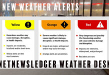
WINNIPEG – WEATHER –The Winter Storm Warning continues tonight for Winnipeg.
Snow at times heavy continues across much of southern Manitoba, except for the Red River Valley and southeastern corner of the province.
In these areas, some light snow or drizzle has been in place for much of the afternoon. Another wave of heavy snow has developed over Northwestern Ontario and will push westwards across southern Manitoba tonight.
Much of southern Manitoba will likely see 10 to 20 cm of snow overnight, except for areas in the southern Red River Valley and southeastern Manitoba. Snow will be lighter in these areas and only 5-10 cm is likely overnight.
Snow and blowing snow will continue Thursday, with a widespread 5-10 cm accumulation across the region. Snow will continue Thursday evening, but accumulations should be limited, before tapering to flurries on Friday.
Further north the Interlake and areas east of Lake Winnipeg will see the majority of the snow tonight through Thursday.
Total snowfall accumulations by the time the time the storm tapers off range from 30-40 cm for Winnipeg, 40-60 cm for the western Red River Valley including Portage La Prairie and Morden, and 20-40 cm for the eastern Red River Valley and southeastern Manitoba.
Travel on area highways may be difficult or impossible. If you must travel, be sure to check highway conditions before leaving and that your car has a winter survival kit.
Conditions should begin to improve on Friday as the winds taper off and the heaviest snow moves into northern Ontario.
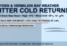
Winnipeg is expecting snow and blowing snow tonight, at times heavy with another ten centimetres possible.
Winds are from the northeast at 40 km/h gusting to 60.
The low overnight will be minus 4. Wind chill minus 11 overnight.
Snow and blowing snow with another 5 to 10 centimetres expected. Winds will be from the north at 30 km/h gusting to 50.
The temperature will drop in the afternoon to -7.


