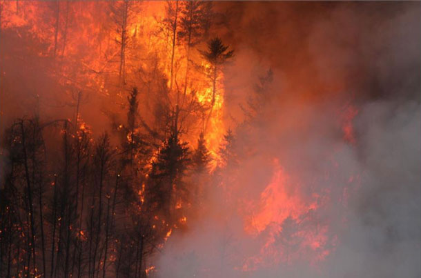
Thunder Bay – Wildfire Update – At the time of this update there were 101 active fires in the northwest region. Thirty fires were not under control, eight fires were being held, 20 fires were under control and 43 fires were being observed. Seven fires were called out today.
There are now crews from Nova Scotia and Mexico.
For the number of readers who asked why the Ontario Government brings in firefighters from other provinces and from places like Mexico when there are First Nation firefighters who have not been hired… NetNewsLedger took the question to Minister Greg Rickford whose office states:
Ontario utilizes Type 2 firefighter service providers during periods of escalated fire activity who assist with sustained attack and mop-up on areas of fire with lower intensity.
Most of the Type 2 firefighters that are hired through our contractors are from Indigenous communities. The contractors maintain an approximate roster of up to 80 Type 2 crews (320 positions) but numbers may vary annually based on recruitment. Ontario currently has 29 contract crews activated and are supporting our efforts to fight forest fires across Northwestern Ontario; however this can vary day to day.
Type 2 crews are hired as needed during the summer when fires are active. During periods of escalated fire activity, Ontario also hires supplemental firefighters to increase NDMNRF crew, as well as service and support staff.
- Five new fires were discovered in the northwest region by the late afternoon of July 18, with more reports yet to be investigated.
- Sioux Lookout 64 (6.0 hectares) and Sioux Lookout 65 (2.0 hectares) are located approximately 9 kilometres and 12 kilometres (respectively) north of Mishkeegogamang First Nation. Both fires are not under control.
- Red Lake 135 is located south of Pringle Lake in an area close to active fire Red Lake 68, approximately 35 kilometres northeast of Red Lake.
- Red Lake 136 (42 hectares) and Red Lake 137 (23 hectares) are located near Malette River, approximately 38 kilometres west of Pikangikum First Nation. Both fires are not under control.
- Red Lake 138 is located west of Oooowee Sahkaheekahn Lake, approximately 28 kilometres east of Poplar Hill First Nation. The 1.0 hectare fire is not under control.
- AFFES is currently responding to many fires on the landscape. Stay informed of the location, size, status of all active wildland fires in the province on the interactive fire map at Ontario.ca/forestfire
- The wildland fire hazard is extreme throughout the Fort Frances and Dryden sectors. High to extreme hazard conditions persist in the Kenora, Thunder Bay and southern portions of Red Lake, Sioux Lookout and Nipigon sectors. Some far north locations feature low to moderate fire hazard.Fires of Note
- Red Lake 65 – of concern to Poplar Hill First Nation
- Fire is sized at 16,065 hectares and is now 7km northwest of the community.
- Fire behaviour is too aggressive to safely put out ground crews. Fire officials are looking for opportunities to bring the fire to natural boundaries.
- Three FireRanger crews assigned to protect the community and critical infrastructure.
- Smoke and visibility pose challenges for using firefighting aircraft in the area.
- The Ministry of the Solicitor General has coordinated an evacuation of the community.
- Red Lake 51 – of concern to Deer Lake First Nation
- Fire size is sized at 48,760 hectares and is located approximately 24 kilometres west of the community.
- Fire behaviour is too aggressive to safely put out ground crews. The safety of our firefighters is a top priority. Fire officials are looking for opportunities to bring the eastern edge of the fire closest to the community fire to natural boundaries.
- Crews are focused on the protection of the community and critical infrastructure.
- The Ministry of the Solicitor General has coordinated an evacuation of the community.
- Red Lake 77 – Fire of concern to Red Lake
- Fire is not under control at 18,114 hectares.
- At its nearest point Red Lake 77 is approximately 28 kilometres west/northwest of Madsen and is located approximately 33 kilometres west of Red Lake.
- Three of four new fire starts to the south of the community have been extinguished or brought under control. One remaining new fire, Red Lake 124 (40 hectares), remains not under control, approximately 11 kilometres south of Madsen.
- Crews are working alongside municipal firefighters to protect the community and critical infrastructure.
- Kenora 51
- Recently remapped at 114,323 hectares, not under control.
- Fire has been active over the past several days producing smoke at the local level
- Crews are establishing hoselines on sections of the fire
- 13 crews and 12 helicopters are assigned to this fire.
- An Incident Management Team is established on the fire.
Restrictions due to forest fire activity in the Red Lake District
The Ministry of Northern Development, Mines, Natural Resources and Forestry, Red Lake District, is advising the public that due to extreme forest fire activity, an Implementation Order is now in effect until further notice that restricts access and use of certain roads and Crown lands.
All travel, use and access to the following areas are prohibited unless authorized by a travel permit issued by the Red Lake District office.
Specifically, all modes of travel and use of the North road, Pineridge Road, Suffel Lake Road, Iriam Road and the portion of Longlegged Road west of the junction of Conifer Road and Longlegged Road.
All modes of travel/access onto Storey lake, Philip lake, Nungesser lake, including the Sahkeesahkahteekoh weesuhkaheegahn (Pringle Lake, Dedicated Protected Area (Ontario Parks)); Woodland Caribou Provincial Park is closed. This includes all access points off Suffel lake Road, Pineridge Road and Iriam Road. Including all modes of travel/access from the Manitoba-Ontario boarder including the Little Grand Rapids dedicated protected planning area, Weeskayjahk Ohtahzhoganiing (Lake country, Dedicated Protected Area) and all Crown land as outlined in the hatched area identified on the Implementation order map.
For information on how to obtain a travel permit please call 807-727-1345.
To view a map of the implementation order area at ontario.ca/forestfire click here.Restrictions due to forest fire activity in the Kenora District – Werner Lake Road
The Ministry of Northern Development, Mines, Natural Resources and Forestry, Kenora District, is advising the public that due to extreme forest fire activity from the Kenora 51 fire, an Implementation Order is now in effect until further notice that restricts access and use of certain roads and Crown lands.
All travel, use and access to the following areas are prohibited unless authorized by a travel permit issued by the Kenora District Ministry of Northern Development, Mines, Natural Resources and Forestry.
This includes all travel and use of the Werner Lake Road from the Manitoba Border eastward to the end of the road.
All use or occupation of Crown lands, on or within 500 metres of the identified road, is prohibited.
For information on how to obtain a travel permit please call 807-468-2501.
To view a map of the implementation order area at ontario.ca/forestfire, click here.
Restricted Fire Zone in effectDue to high to extreme forest fire hazard conditions, effective 12:01 a.m. Saturday July 10, the Ontario Ministry of Northern Development, Mines, Natural Resources and Forestry has issued updated boundaries for a Restricted Fire Zone in the Kenora, Fort Frances, Dryden and Thunder Bay Districts and portions of the Sioux Lookout, Red Lake, Nipigon and Wawa Districts. The Restricted Fire Zone will be in effect until further notice. Outdoor fires are banned. Portable gas stoves may still be used BUT must be handled with extreme care. You can learn more about Restricted Fire Zones here. For a more detailed boundary of the Restricted Fire Zone see the attached map, consult the interactive fire map at Ontario.ca/forestfire or find the map here.


