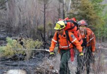
Thunder Bay – Wildfire Update – There are thirty-four active wildfires in the region.
Northwest Region
- There was one new fire confirmed in the northwest region by the late afternoon of June 12.
-
- Thunder Bay 42 has been declared out at 0.1 hectares and was located near Beagle Lake, approximately 46 kilometres southwest of Armstrong.
- At the time of this update there were 34 active fires in the region. Seven fires are not under control, 12 are being observed, four fires are being held and 11 fires are under control.
- The wildland fire hazard is mainly low to moderate with areas of high hazard in the Fort Frances district.
- To see the fire hazard near you, consult the interactive fire map at Ontario.ca/forestfire
Fires of Note
Nipigon 7 – Located 45 kilometers northeast of the town of Nipigon. This fire is not under control and has been remapped to 2410 hectares following favourable flying weather conditions. This change in size represents growth on the fire from a few days ago. Five crews have been assigned to this fire with more being deployed over the next few days. Four helicopters are assigned to this fire. Fire behaviour was minimal on the Nipigon 7 today.
Nipigon 8 – Located 40 kilometers northeast of the town of Nipigon. This fire is being held at 150 hectares. There are nine crews and two helicopters assigned to this fire.
Thunder Bay 33 – Located 141 kilometres north of Thunder Bay in the Holinshead Lake area. This fire is being held at 216.7 hectares. Crews and heavy equipment continue to make great progress on the fire.
Thunder Bay 36 – Located near Bedivere Lake, approximately 30 kilometres southwest of Upsala. This fire is not under control at 500 hectares. Crews are making great progress on this fire.
Restrictions due to forest fire activity in Nipigon District
The Ministry of Natural Resources and Forestry – Nipigon District, is advising the public that due to forest fire activity in the Nipigon area from the Nipigon fires 7,8 and 9, an Implementation Order is in effect that restricts access and use of certain roads and Crown lands. All travel, use and access to the following areas are prohibited unless authorized by a travel permit issued by the Nipigon District Ministry Of Natural Resources and Forestry. All roads north of the Camp 81 Road/Devious Lake junction and west of the Camp 81 Road/John Ahl Road/Hainsworth Road junction; including Weatherall Lake Road, Cosgrave Lake Road, Seahorse Lake Road and Foam Lake Road.
All use or occupation of Crown land on or within 500 metres of the described closed roads above is prohibited.


