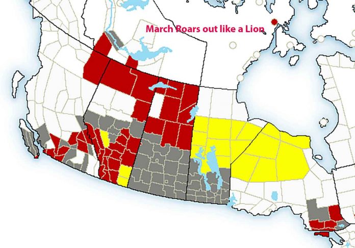
WINNIPEG – WEATHER – March is heading out roaring like a lion. Environment Canada has weather warnings, alerts and advisories out right across Western Canada including Saskatchewan, Manitoba and Ontario.
The alerts in Manitoba are a concern for Western Ontario as the weather service says that the weather system, a strong low pressure system will be getting into Ontario on Tuesday evening.
There are weather advisories in effect currently for Ontario’s Far North.
NetNewsLedger will be updating our coverage as this system winds its way toward our region.
Special weather statement in effect for:
- City of Winnipeg
Active spring weather ahead for Manitoba on Monday to Tuesday night.
A strong low pressure system currently developing over Alberta will track eastwards across the central Prairies early this week giving strong winds, heavy snow, blowing snow and patchy freezing rain beginning overnight Sunday into Monday morning and lasting into Tuesday evening.
Southern Manitoba will see a brief period of mild temperatures on Monday as southerly winds usher in warm temperatures ahead of the developing low. Temperatures will rise into the mid to upper teens by mid day followed by rapidly falling temperatures into the minus teens by evening and overnight behind a strong cold front.
Southwestern portions of the province will see strong to severe winds on Monday afternoon with gusts as high as 90 km/h. Further east, into the Red River Valley and Interlake, winds will still be strong, with gusts to 70 or 80 km/h likely.
Also accompanying the cold front will be moderate to heavy flurry activity or snow squalls, some of which may start out as rain showers before switching over to snow as temperatures plummet. Local snowfall amounts across the south will be in the 2 to 4 cm range while heavier snow is likely across the central Interlake where 5 to 10 cm will be possible. The heaviest snow will track from east of Lake Winnipeg northwards into central and northern Manitoba, where Winter Storm Watches are in effect. Blowing snow will reduce visibilities to near zero at times in heavy flurry activity so travel will be particularly hazardous late Monday into Monday night and Tuesday.
Conditions will improve on Tuesday evening as the low pressure system pulls off into Ontario.

