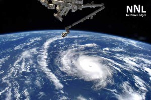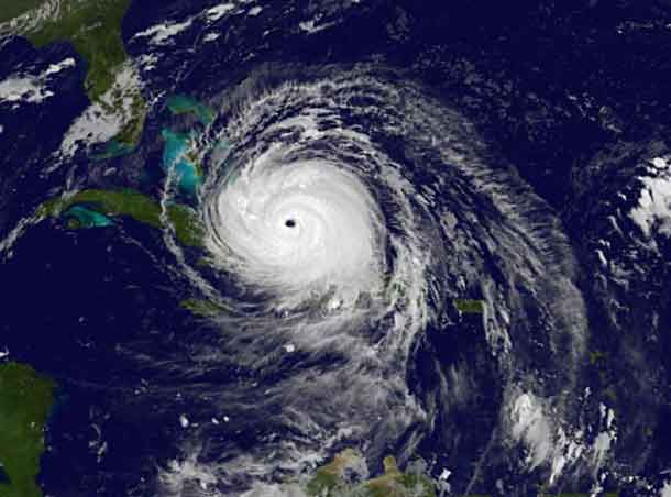
When storms such as Harvey and Florence come to a virtual stall, a deluge of rain can fall in the matter of days, equal to what an area typically sees in a year
By Jon Herskovitz
(Reuters) – Global warming has increased the likelihood of more massive, sluggish storms like Florence, capable of dropping record amounts of rain and causing the type of catastrophic flooding that crippled North and South Carolina this week, experts said.
Most meteorologists agree that climate change can increase the volume of water vapor stored within weather systems. More water vapor means more rain, especially when the storm is a crawler like Florence, which slowed to about 2 miles per hour (3.2 km per hour) after slamming into the North Carolina coast.

When storms such as Harvey, which struck Texas last year, and Florence come to a virtual stall, a deluge of rain can fall in the matter of days, equal to what an area typically sees in a year, they said.
“It is compelling and sobering to see these storms come in back-to-back seasons,” said Jim Kossin, an atmospheric research scientist with the U.S. National Oceanic and Atmospheric Administration.
His research suggests that global warming has affected the speed of storms as well as the amount of moisture they contain.
Florence, which has killed at least 36 people, dumped up to 36 inches (91 cm) of rain in parts of North Carolina since Thursday. At least 16 rivers remained at a major flood stage, with three others set to crest in the coming days in North Carolina, the state said.
It has been a little more than a year since Hurricane Harvey dumped trillions of gallons of water on Texas and the U.S. Gulf Coast, killing 68 people and causing an estimated $125 billion in property damage.
Based on data from about seven decades of storms, Kossin found tropical-cyclone speed had decreased globally by 10 percent from 1949 to 2016, according to a paper published in June in the scientific journal Nature.
The reason is that climate change is warming the Arctic much more than it is heating up the Tropics, easing the pressure difference between the two, he said in an interview on Wednesday.
Pressure differences drive the winds, which in turn can steer and slow down storms, he said.
In the case of Florence, warmer sea temperatures and the amount of available moisture in the air may have increased rainfall by as much as 50 percent in the hardest-hit areas, according to a study by researchers at Stony Brook University, Lawrence Berkeley National Laboratory and the National Center for Atmospheric Research.
To make matters worse, Florence was about 50 miles (80 km) larger in diameter due to global warming, putting more people in harm’s way, the study showed.
“We can attribute that additional rainfall to human-induced climate change,” said Kevin Reed, a professor at Stony Brook University’s School of Marine and Atmospheric Sciences, who contributed to the study.
The paper, still unpublished, may fuel an ongoing debate in the scientific community about whether climate change, induced by human activity, has a direct impact on the strength and size of a storm.
Global warming has greatly increased the chances of another storm of Harvey’s magnitude hitting Texas again, according to a published study by Massachusetts Institute of Technology Professor Kerry Emanuel.
The likelihood of more massive rainfalls also should raise red flags for both coastal and inland communities and get them to rethink plans for storm-related inundation, experts said.
This includes planning for massive evacuations and making improvements to infrastructure related to water-flow resources to help ease the blow.
Most of the damage caused by Harvey and Florence has come from the flooding, which has devastated cities and rural areas, turning highways into rivers and pastures into lakes.
“There is going to be both more inland flooding and more storm-surge, ocean-related flooding because the ocean is getting higher,” said Brion Callori, senior vice president of engineering and research at commercial property insurance firm FM Global.
“The biggest risk is burying your head in the sand and not understanding your exposure,” he said.
(Reporting by Jon Herskovitz in Austin, Texas; Editing by Lisa Shumaker)


