Emergency Area Order – Kenora Fire 71
THUNDER BAY – WILDFIRE UPDATE – The Ministry of Natural Resources and Forestry has issued an Emergency Area Order (EAO) in the vicinity of Kenora Fire 71 to ensure public safety and effective firefighting.
As a result, all travel and use of the Werner Lake Road from the Manitoba Border eastward to the end of the road is prohibited. All use of Crown Land on or within 500 metres of this road is also prohibited.
Kenora Fire 71 Update
Kenora Fire 71 is located approximately six kilometres east of the Manitoba border, and 80 kilometres north of the city of Kenora. On Wednesday, July 18, the fire grew from approximately 3,000 to 6,800 hectares progressing a distance of nearly 10 kilometres to the northeast towards Trapline Lake. Values protection equipment installed by fire crews has so far been successful. To date, no structures are known to have been lost.
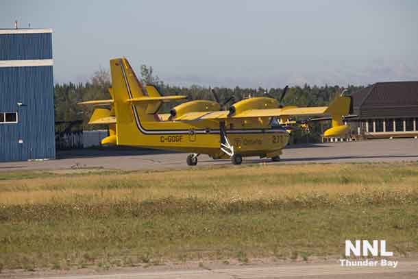
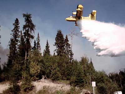
Approximately 20 fire ranger crews continue to install sprinkler systems on structural values, and lay hose lines around the perimeter of the fire. Helicopters and water bombers are also on scene. An incident command team has been assigned to these fires with a base camp in Minaki as a staging area for a full suppression response, once resources are in place.
Kenora Fire 71 continues to produce significant smoke drift affecting communities in the Lake of the Woods area.
Those with urgent health concerns should contact Ontario Telehealth at 1-866-797-0000.
Fires in Woodland Caribou Provincial Park
Woodland Caribou Provincial Park, west of the town of Red Lake currently has 13 fires within its boundaries, most of them under observation is this remote access park. The past 24 hours saw a few of those fires as they grew in size.
Red Lake Fire 76 is now 5,000 hectares in size. Neighbouring to the north is Red lake Fire 81 which is now 4,200 hectares. Red Lake Fire 97 has grown to 2,300 hectares. The MNRF is relocating crews from manned fires in response to the significant growth. Smoke drift from these fires will be noticeable in communities to the east such as Red Lake and Ear Falls. . Those with urgent health concerns should contact Ontario Tele-health at 1-866-797-0000.
New fires for July 19
There were three new fires in the Northeast region by the late afternoon of July 19.
- Red Lake Fire 115 is located near the south shore on Nungesser Lake. The 85 hectare fire is currently not under control.
- Nipigon Fire 43 was found south of Raynar Lake approximately 19 kilometres north of the community of Longlac. The 0.3 hectare lightning-caused fire is currently not under control.
- Sioux Lookout Fire 81 is located on a peninsula on the east side of Lac Seul, approximately 22 kilometres north of the community of Sioux Lookout. The fire is currently not under control.
At the time of this post there were 90 active fires in the region, 67 of which are either under observation, being held or under control. Seven fires were recently declared out.
Fire Hazard for the Northwest Region
Currently, the hazard is high across most of the region with pockets of extreme hazard in the Red Lake and Kenora districts while the far north is showing a low to moderate hazard.
To see a complete list of fires across the province click on our interactive map. You can also get the latest update on the condition of any fire by clicking the fire icon.
Fire numbers and online information:
- Forest Fire Reporting Number – 310-FIRE (3473)
- Twitter account

