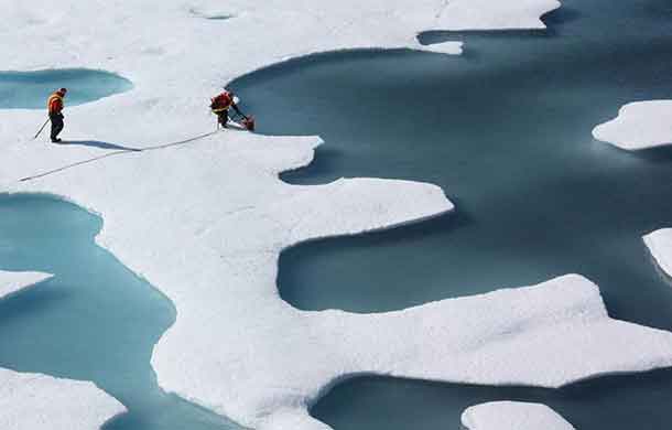

ZURICH – CLIMATE – In the winter of 2015/16, something happened that had never before been seen on this scale: at the end of December, temperatures rose above zero degrees Celsius for several days in parts of the Arctic. Temperatures of up to eight degrees were registered north of Svalbard. Temperatures this high have not been recorded in the winter half of the year since the beginning of systematic measurements at the end of the 1970s. As a result of this unusual warmth, the sea ice began to melt.
“We heard about this from the media,” says Heini Wernli, Professor of Atmospheric Dynamics at ETH Zurich. The news aroused his scientific curiosity, and a team led by his then doctoral student Hanin Binder investigated the issue. In November 2017, they published their analysis of this exceptional event in the journal Geophysical Research Letters.
In it, the researchers show how these unusual temperatures arose: three different air currents met over the North Sea between Scotland and southern Norway, carrying warm air northwards at high speed as though on a “highway”.
One air current originated in the Sahara and brought near-surface warm air with it. To begin with, the temperature of this air was about 20 degrees Celsius. While it cooled off on its way to the Arctic, it was still above zero when it arrived. “It’s extremely rare for warm, near-surface subtropical air to be transported as far as the Arctic,” says Binder.
The second air current originated in the Arctic itself, a fact that astonished the scientists. To begin with, this air was very cold. However, the air mass – which also lay close to the ground – moved towards the south along a curved path and, while above the Atlantic, was warmed significantly by the heatflux from the ocean before joining the subtropical air current.
The third warm air current started as a cold air mass in the upper troposphere, from an altitude above 5 kilometres. These air masses were carried from west to east and descended in a stationary high-pressure area over Scandinavia. Compression thereby warmed the originally cold air, before it entered the “highway to the Arctic”.
Poleward warm air transport
This highway of air currents was made possible by a particular constellation of pressure systems over northern Europe. During the period in question, intense low-pressure systems developed over Iceland while an extremely stable high-pressure area formed over Scandinavia. This created a kind of funnel above the North Sea, between Scotland and southern Norway, which channelled the various air currents and steered them northwards to the Arctic.
This highway lasted approximately a week. The pressure systems then decayed and the Arctic returned to its typical frozen winter state. However, the warm period sufficed to reduce the thickness of the sea ice in parts of the Arctic by 30 centimetres – during a period in which ice usually becomes thicker and more widespread.
“These weather conditions and their effect on the sea ice were really exceptional,” says Binder. The researchers were not able to identify a direct link to global warming. “We only carried out an analysis of a single event; we didn’t research the long-term climate aspects” emphasises Binder.
High-pressure systems cause sea ice to melt
However, the melting of Arctic sea ice during summer is a different story. The long-term trend is clear: the minimum extent and thickness of the sea ice in late summer has been shrinking continually since the end of the 1970s. Sea ice melted particularly severely in 2007 and 2012 – a fact which climate researchers have thus far been unable to fully explain. Along with Lukas Papritz from the University of Bergen, Wernli investigated the causes of these outliers. Their study has just been published in the journal Nature Geoscience.
According to their research, the severe melting in the aforementioned years was caused by stable high-pressure systems that formed repeatedly throughout the summer months. Under these cloud-free weather conditions, the high level of direct sunlight – the sun shines 24 hours a day at this time of year – particularly intensified the melting of the sea ice.
Areas of low pressure “inject” air masses into the Arctic
These high-pressure systems developed through an influx of air from temperate latitudes. Low-pressure systems in the North Atlantic and North Pacific areas, for example, “inject” air masses into the Arctic at a height of about eight kilometres. This raised the height of the tropopause, the boundary between the troposphere and the stratosphere, in the region of the “injections”. As a result, surface air pressure below rose and a high-pressure system was established. While it dissipated again around ten days later, an unusually high amount of sea ice melted in the interim, and the remaining ice thinned.
The climate scientists’ investigation demonstrated that in the summers of 2007 and 2012, during which these high-pressure situations occurred particularly frequently, they led to cloud-free conditions every third day. The high level of solar radiation intensified and accelerated the melting of the sea ice. “The level of solar radiation is the main factor in the melting of the ice in summer. Unlike with the winter anomaly, the “injected” air at about 8-kilometre altitude from the south is not warm – with minus 60 degrees it’s ice-cold,” says Wernli.
“The air temperature, therefore, has very little effect on the ice.” Furthermore, the northward transport of warm, humid air masses at the edge of the high-pressure systems reduces (heat) emission, which further intensifies melting.
Their analysis has allowed the researchers to understand the meteorological processes leading to significant variations in summertime ice melt for the first time. “Our results underline the fundamental role that weather systems in temperate latitudes play in episodes of particularly intense ice melt in the Arctic,” says the ETH professor.


