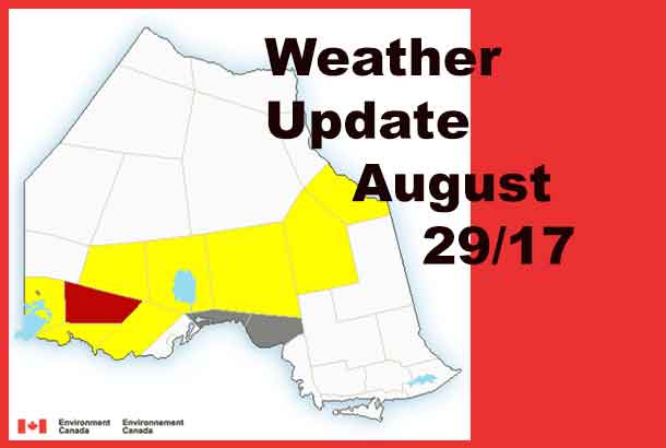
THUNDER BAY – A band of severe Thunderstorms are tracking across Northwestern Ontario this evening.
The weather service issued warnings across a wide swath of the region.
The most severe weather alert is for the Dryden, Vermilion Bay out to Ignace and English River.
9:40 PM EDT Tuesday 29 August 2017
Severe thunderstorm warning in effect for:
- Dryden – Vermilion Bay
- Ignace – English River
At 8:40 p.m. CDT (9:40 p.m. EDT), Environment Canada meteorologists are tracking a line of severe thunderstorms capable of producing very strong wind gusts, up to nickel size hail and heavy rain.
The line of thunderstorms stretches from south of Dryden towards English River and Graham. The line is moving to the southeast at 40 km/h.
9:10 PM EDT Tuesday 29 August 2017
Severe thunderstorm watch in effect for:
- Atikokan – Shebandowan – Quetico Park
- Upsala – Raith
- Armstrong – Auden – Wabakimi Park
- Beardmore – Jellicoe – Macdiarmid
- Gull Bay – Black Sturgeon Lake
- Savant Lake – Sturgeon Lake
- Upsala – Raith
Conditions are favourable for the development of severe thunderstorms that may be capable of producing strong wind gusts, large hail and heavy rain.
A line of thunderstorms has developed this evening ahead of an approaching cold front. This line of thunderstorms is moving from northwest to southeast across northern Ontario.
The thunderstorms are expected to slowly weaken as the evening progresses.
Large hail can damage property and cause injury. Strong wind gusts can toss loose objects, damage weak buildings, break branches off trees and overturn large vehicles. Lightning kills and injures Canadians every year. Remember, when thunder roars, go indoors!


