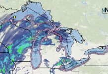
THUNDER BAY – WEATHER – Heavy rains in southeastern Minnesota have created dangerous river conditions and impacted access to some state parks and trails, according to the Department of Natural Resources.
Travel on these fast-moving, swollen rivers should be avoided:
The Zumbro, Cannon, Straight, Whitewater and Root rivers — all currently rated “very high.”
The Minnesota River — expected to hit minor flood stage in Jordan by Tuesday.
Portions of the Mississippi and St. Croix rivers — high and projected to continue rising over the next several days.
High water conditions can persist in rivers and lakes for an extended period of time following flooding events. Water recreationists should avoid flooded water bodies, stay alert for potential storm debris in waterways, and be sure to wear a life jacket at all times.
For current river level reports, check www.mndnr.gov/river_levels. The state water trails website provides additional safety information and can help you locate rivers unaffected by the flooding.
State park impacts
Myre-Big Island State Park near Albert Lea — heavy rains are in danger of overwhelming the water treatment system the park uses so showers, flush toilets, and trailer dump stations will be closed through the remainder of the regular camping season, which ends Oct. 23. Drinking water and vault toilets will still be available at both campgrounds.
Sakatah Lake State Park near Faribault — hiking trails are closed until further notice. Campgrounds and other amenities remain open and accessible.
Nerstrand Big Woods State Park near Northfield — park trails are closed until further notice. The campground, dump station and shower building remain open.
Whitewater State Park near Winona — the Lower Cedar Campground is closed (the Gooseberry Campground was already closed due to stream rehab work).
Beaver Creek Valley State Park in Caledonia — The campground was already closed for culvert installation.
State trail impacts
The Sakatah Singing Hills State Trail is closed between Sakatah Lake State Park west to State Highway 13.
The Minnesota Valley State Trail is closed from Belle Plaine to Chaska.
The Root River State Trail is closed between Whalan and Houston.
The southern portion of the Goodhue-Pioneer State Trail (around Zumbrota) is closed.
For questions related to camping and lodging reservations, call the DNR Reservation Center at 866-857-2757. For other information, check the individual state park webpages for updates at www.mndnr.gov or contact the DNR Information Center at info.dnr@state.mn.us or 888-646-6367 (between 8 a.m. and 4:30 p.m. Monday through Friday).


