On May 6, 2016 all of Fort McMurray remains under a mandatory evacuation order. The Fort McMurray International Airport remains open at this time.
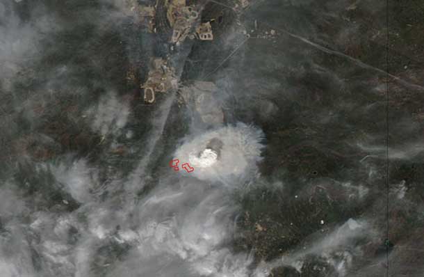
Suomi NPP’s Visible Infrared Imaging Radiometer Suite (VIIRS) instrument captured a look at the fire and the smoke generated by the fire during the daytime on May 5, 2016 at 3:45 p.m. EDT (19:45 UTC). In the image, the hotspots indicate the location of the fires. The smoke was blowing to the south-southeast of the fires in Fort McMurray. Suomi NPP is a joint mission of NASA, NOAA and the Department of Defense.

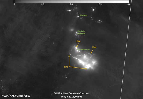
On May 6, 2016 at 5:56 a.m. EDT (0956 UTC), the VIIRS instrument on Suomi NPP acquired a nighttime image of the Fort McMurray wildfire by using its “day-night band” to sense the fire in the visible portion of the spectrum. In the image, the brightest parts of the fire appear white while smoke appears light gray.
According to the Alberta Department of Agriculture and Forestry (ADAF) on May 6, 2016 the following communities are under an evacuation order: Fort McMurray, Anzac, Gregoire Lake Estate and Fort McMurray First Nation. The high level evacuation order has been lifted (at noon MDT on May 5). For more details, visit the ADAF page: http://wildfire.alberta.ca/.
Alberta’s Regional Municipality of Wood Buffalo (RMWB) reported on May 5, 2016 at 9:20 p.m. MDT, that the Anzac/Gregoire Lake Estates and the Stone Creek Area remains an active fire zone. The Birchwood Trails remains a priority from a strategic firefighting standpoint and crews are working hard to protect this area. RMWB noted that gusting winds have been extremely challenging for fire crews and properties near green areas remain an issue due to sparks and high winds creating spot fires among housing. A plan is being developed for northern evacuees. For updates from RMWB, visit: http://asset.rmwb.ca/wildfire/
The Government of Alberta Transportation noted on May 6, 2016 that due to heavy smoke and fire, motorists are being asked not to travel to Fort McMurray on either Highway 63 or Highway 881. Highway 881 is closed to through traffic at Anzac, until further notice.
On May 6, 2016 Alberta Emergency Alert posted that in Mackenzie County, the evacuation order will been lifted as of 12:00 p.m. MDT for residents living in Township 109 range 19 west of 5 between Townships road 1090 and 1094 east to the Bushe River, also 17,18,19,28,29,30,31,32 Township 108 Range 18 west 5. Residents are to remain on immediate alert in case the situation changes due to weather changes.
For emergency information: http://www.emergencyalert.alberta.ca/.


