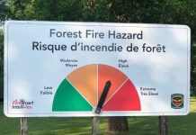
THUNDER BAY – ENVIRONMENT –There are now 365 personnel from the Ontario Ministry of Natural Resources and Forestry on assignment in British Columbia (263) and the Northwest Territories (102) to assist in ongoing forest fire management efforts. The fire hazard in Ontario in the far north is moderate to high hazard.
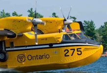
Extreme conditions in British Columbia, the Yukon and Northwest Territories have crews working there. Ontario had 32 Fire Rangers and 2 Overhead staff members return from the Northwest Territories yesterday. Today, Ontario is sending out two CL415 water bombing aircrafts and one Birddog aircraft with an air Air Attack Officer to the Northwest Territories.
Ontario has also provided equipment including 400 power pumps, 2,000 lengths of hose and two values protection units to British Columbia.
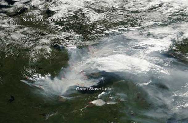
Fires and the resultant smoke that comes from them are both just as widespread and heavy as they were in the month of July. Hundreds of fires dot the landscape and the Northwest Territories Live Fire map shows the extent of the wildfires and hot spots that have been reported. Fire danger around this area of the Northwest Territories remains in either the high or extreme range. On the live fire map, notated detections of new fires number in the dozens. These fires are ones having been detected within the last 24 hours. Residents of Yellowknife were witness to red lightning recently due to the amount of smoke in the atmosphere coloring the lightning strikes.
Environment Canada reported that the Air Quality Health Index reached 12 on Sunday, Aug. 03, 204. It explained that “the higher the number, the greater the health risk associated with the air quality. When the amount of air pollution is very high, the number will be reported as 10+.”
Since early June and the beginning of the Northwest Territories fire season, there have been 333 fires that have burned over 2.8 million hectares of land (6,918,950 acres). This information is from the Aug. 3, 2014 NWT Fire Situation Report.
This natural-color satellite image was collected by the Moderate Resolution Imaging Spectroradiometer (MODIS) aboard the Aqua satellite on Aug. 03, 2014. Actively burning areas, detected by MODIS’s thermal bands, are outlined in red.Credit: NASA image courtesy Jeff Schmaltz, MODIS Rapid Response Team. Caption: NASA/Goddard, Lynn Jenner with information from Northwest Territories fire website


