Severe Weather Tracking through Nortwestern Ontario
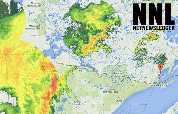
THUNDER BAY – The forecast is still calling for rain and thunderstorms. The weather radar image, captured at 23:55 on July 21st shows large storm systems in the region.
The Lakehead Region Conservation Authority has issued a Flood Update for the region around Thunder Bay.
Environment Canada has issued a Severe Thunderstorm Watch for:
- City of Thunder Bay
- Kenora
- Nestor Falls
- Dryden
- Ignace
- Fort Frances
- Rainy Lake
- Atikokan
- Upsala
- Quetico
- Superior West
Severe thunderstorm conditions possible – evening to overnight
A developing low pressure system over North Dakota combined with a warm front across northern Minnesota is expected to trigger severe thunderstorms this evening across portions of northwestern Ontario.
Thunderstorms are developing over portions of the northwest and are expected to persist overnight. Heavy rainfall and damaging winds are the primary threats. As the thunderstorms evolve it is quite possible that they will transition into a broad area of heavy rain resulting in local rainfall amounts of 60mm. Rainfall warnings have been issued for some regions and may need to be extended to other regions.
Large hail can damage property and cause injury. Very strong wind gusts can damage buildings, down trees and blow large vehicles off the Road. Remember, severe thunderstorms can produce tornadoes. Be prepared for severe weather. Take cover immediately, if threatening weather approaches. In Canada, lightning kills up to 10 people every year. Remember, when thunder roars, go indoors.
Emergency management Ontario recommends that you take cover immediately, if threatening weather approaches.
Environment Canada meteorologists will update alerts as required, so stay tuned to your local media or weatheradio. Email reports of severe weather to storm.Ontario(at)ec.Gc.CA or tweet with the hashtag (hash)onstorm.


