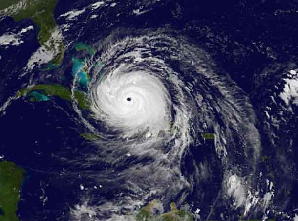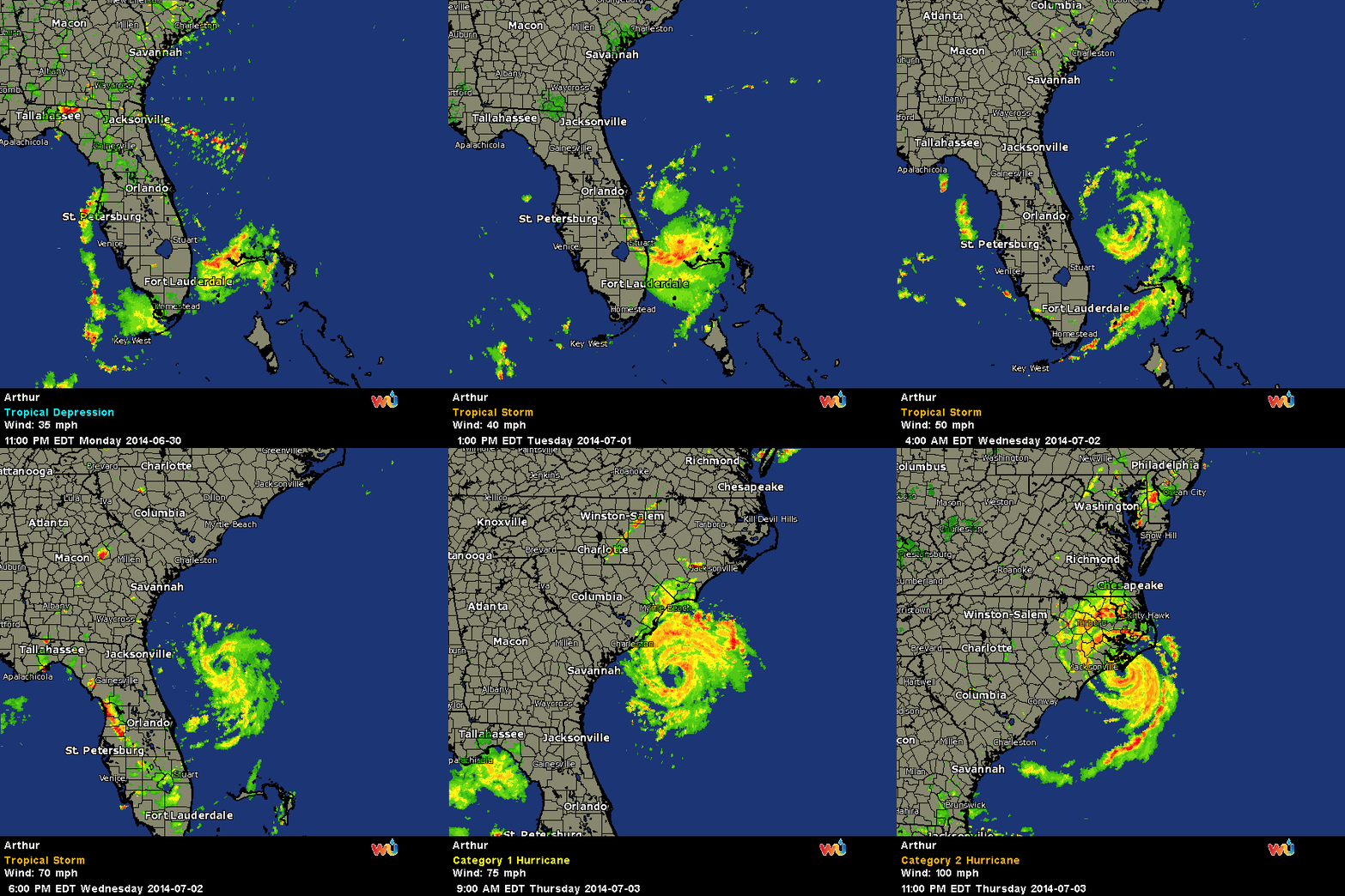
THUNDER BAY – WEATHER – The Eye of Hurricane Arthur is about to make landfall near Cape Lookout. The hurricane has been growing in strength throughout the day. At 1100 PM EDT…0300 UTC…the center of Hurricane Arthur was located near latitude 34.6 north…longitude 76.6 west. Arthur is moving toward the northeast near 18 mph…30 km/h…and this motion is expected to continue with an increase in forward speed during the next couple of days. On the forecast track…the center of Arthur should pass over the coastal area of eastern North Carolina during the next several hours…pass southeast of New England Friday or Friday night…and be near or over western Nova Scotia early Saturday.
Summary of 1100 PM EDT…0300 UTC…information
———————————————–
location…34.6n 76.6w
about 0 mi…0 km N of Cape Lookout North Carolina
about 75 mi…120 km WSW of Cape Hatteras North Carolina
maximum sustained winds…100 mph…155 km/h
present movement…NE or 35 degrees at 18 mph…30 km/h
minimum central pressure…976 mb…28.82 inches
Watches and warnings
——————–
changes with this advisory…
The Tropical Storm Warning has been discontinued south of Cape Fear.
Environment Canada has issued a tropical storm watch for the coast of New Brunswick from the U.S./Canada border to grand-Anse…all of Nova Scotia including Cape Breton island…and all of Prince Edward Island.
Summary of watches and warnings in effect…
A Hurricane Warning is in effect for…
* Surf City North Carolina to the North Carolina/Virginia border
* Pamlico Sound
* eastern Albemarle Sound
A Tropical Storm Warning is in effect for…
* Cape Fear to south of Surf City
* the North Carolina/Virginia border to Cape Charles Light
Virginia…including the mouth of the Chesapeake Bay
* western Albemarle Sound
* Nantucket
* Cape Cod from Provincetown to Chatham
A tropical storm watch is in effect for…
* New Brunswick from the U. S./Canada border to grand-Anse
* all of Nova Scotia including Cape Breton island
* all of Prince Edward Island
A Hurricane Warning means that hurricane conditions are expected somewhere within the warning area.
Preparations to protect life and property should have already been completed.
A Tropical Storm Warning means that tropical storm conditions are expected somewhere within the warning area.
Interests elsewhere in coastal portions of New England…New Brunswick…and Newfoundland should monitor the progress of Arthur.
For storm information specific to your area in the United States…including possible inland watches and warnings…please monitor products issued by your local National Weather Service forecast office. For storm information specific to your area outside the United States…please monitor products issued by your National
meteorological service.
Discussion and 48-hour outlook
——————————
At 1100 PM EDT…0300 UTC…the center of Hurricane Arthur was located near latitude 34.6 north…longitude 76.6 west. Arthur is moving toward the northeast near 18 mph…30 km/h…and this motion is expected to continue with an increase in forward speed during the next couple of days. On the forecast track…the center of
Arthur should pass over the coastal area of eastern North Carolina during the next several hours…pass southeast of New England Friday or Friday night…and be near or over western Nova Scotia early Saturday.
Maximum sustained winds are near 100 mph…155 km/h…with higher gusts. Little change in strength is expected tonight.
However…Arthur is expected to begin weakening on Friday and become a Post-tropical cyclone Friday night or Saturday.
Hurricane force winds extend outward up to 40 miles…65 km…from the center…and tropical storm force winds extend outward up to 150 miles…240 km. The NOAA automated station at Cape Lookout North Carolina recently reported sustained winds of 71 mph…115 km/h… and a wind gust of 84 mph…135 km/h.
The minimum central pressure based on Air Force Reserve hurricane hunter and buoy data is 976 mb…28.82 inches.
Hazards affecting land -wind…tropical storm conditions are spreading across portions of the North Carolina/Virginia warning area…and should spread northward through that area during the remainder of tonight.
Hurricane conditions are currently spreading onto the coast near Cape Lookout…and should spread across other portions of the Hurricane Warning area during the next few hours. Tropical storm conditions are expected to reach the New England warning area by Friday night.
Storm surge…the combination of a dangerous storm surge and the tide will cause normally dry areas near the coast to be flooded by rising waters. The water could reach the following heights above ground if the peak surge occurs at the time of high tide… North Carolina within the Hurricane Warning area…3 to 5 ft Pamlico and Albemarle sounds…2 to 4 ft southern North Carolina within the Tropical Storm Warning area…1 to 3 ft
extreme southeastern Virginia…1 to 3 ft
Coastal flooding is also possible along Cape Cod.
The highest water will occur along the immediate coast in areas of onshore flow. The surge will be accompanied by large and damaging waves. Surge-related flooding depends on the relative timing of the surge and the tidal cycle…and can vary greatly over short distances. For information specific to your area…please see products issued by your local National Weather Service office and the new experimental potential storm surge flooding map for more details.
Rainfall…rainfall accumulations of 4 to 6 inches…with isolated maximum amounts of 8 inches…are expected over coastal areas of North Carolina through Friday. Rainfall accumulations of 2 to 4 inches are expected over portions of eastern Massachusetts and Rhode Island.
Tornadoes…isolated tornadoes are possible over portions of coastal North Carolina and southeastern Virginia through Friday morning.
Surf…swells generated by Arthur are affecting areas along the coast of North Carolina. These swells are expected to cause life-threatening surf and rip currents. For more information… please monitor products issued by your local National Weather Service forecast office.
Next advisory -next intermediate advisories…100 am EDT and 300 am EDT.
Next complete advisory…500 am EDT.
$$
Forecaster Beven

