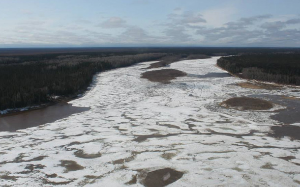
MOOSE FACTORY – Another flight was conducted this evening at 5:40pm and the duration of this flight was approximately 1 hour and 15 minutes. The flight was to observe the current location of the Moose River breakup and the water levels that are behind it and the Abitibi River breakup location and water levels.
As of 6:30pm Moose River breakup remains at the mouth of the Abitibi River, but has moved in a couple of areas about a hundred yards. Breakup is still approximately 18 miles from the communities of Moosonee/Moose Factory. The ice jam has decreased to approximately 5 miles in length. The water levels that are associated with the Moose River breakup remain high. At the current location of breakup the water level has risen approximately 1-2 feet. This is expected with breakup. All low lying areas along the river banks are still experiencing over bank flooding. At the end of the ice jam there is open water with minimal ice floating down. The water level behind the breakup has dropped 1-2 feet. This is a clear indication that the water levels and flows upstream of the Moose River Crossing are decreasing.
Abitibi River breakup location remains approximately 5 miles from the mouth of this waterway. The ice jam is approximately 5 miles long. The water levels and flow rates above breakup remain high and the water levels and flow rates below breakup are moderate.
No Change in North French River’s current location of breakup remains about ¼ of a mile upstream from the mouth of this river. The water levels in this waterway are moderate with gradually increasing flow rates to help push the ice out and in to the Moose River.
No Change in Kwatabohegan River breakup is at or near the mouth of this river and the water levels and flow rates remain constant. However, there is over bank flooding in low lying areas along the shoreline of this waterway.
Cheepash River has broken up to the mouth and the end of the ice jam is near the mouth of the river. The water levels and flow rates remain moderate.
Water levels continue to fluctuate around Moose Factory and Moosonee. This waterway is intact up to its current location of Abitibi River at the time of flight, with open sections along all shorelines and where there is fast moving water. Expected time of arrival of breakup near Moose Factory and Moosonee could be between 6-12 hours, but could be longer or sooner. (We can’t really predict this).
When breakup nears Moosonee and Moose Factory, we can expect to see significant increasing water levels and flow rates.
Moose Factory will remain at Level 3 – Warning Alert – Water levels are rising and breakup is within 20 miles from the community.
Please remain clear of the river banks due to the increased flow rates along the river.
Have a great evening Moosonee/Moose Factory
Michael Delaney/Curt Wesley – Moose Factory Emergency Operations Coordinators
Steve Crown – Moosonee Community Emergency Management Coordinator


