Late Winter Storm Tracking Across Region
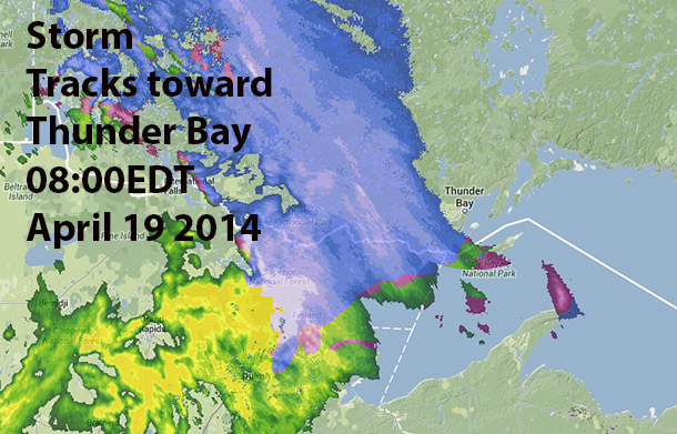
THUNDER BAY – WEATHER – A low pressure system over Southern Saskatchewan with a warm front extending southeast across North Dakota is moving northeastward and will track across Central Manitoba to Far Northern Ontario by Sunday morning.
A band of snow has arrived over areas near the Manitoba and Minnesota borders as expected and will continue to move northeast into remaining regions during the day today. Latest indications continue to suggest a 5 to 10 cm snowfall across the district before the warm front and above freezing temperatures arrive. Freezing rain or ice pellets are also possible before temperatures rise above zero and the precipitation changes over to a few showers. The changeover is expected this morning over western sections, but will be delayed until this evening for areas near Lake Superior including the Lakehead at Thunder Bay.
There is some potential for snow at times heavy with more than 10 cm locally today in a few localities. Environment Canada is closely monitoring the situation. Snowfall and/or freezing rain warnings may be required for some regions as necessary.


