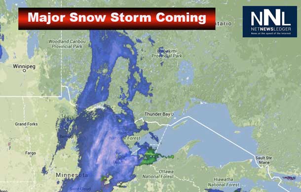

THUNDER BAY – Weather – Two weather systems, both tracking toward the Great Lakes, will merge and rapidly intensify into a major winter storm by this evening. The storm centre is expected to reach Lake Superior overnight, then move through Northern Ontario towards James Bay on Friday.
Snow in Kenora is already over 10 centimetres. Snowfall amounts are going to vary across Northwestern Ontario.
Snow will move into the regions by this evening and quickly become heavy at times. There will likely be a changeover to ice pellets and freezing rain in the Wawa – White River – Pukaskwa region overnight.
Total snowfall amounts of 25 to 30 cm of snow are forecast for tonight and Friday, except in the Wawa – White River – Pukaskwa region, where near 15 cm of snow and some freezing rain are expected.
Dangerous winter driving conditions are expected. Visibility may be reduced to near zero at times in heavy snow, and will also be significantly reduced Friday due to blowing snow as strong and gusty northerly winds develop.
Travellers are urged to adjust or postpone their plans accordingly. If travel is necessary, check highway conditions and for possible highway closures before departing.
Northwestern Ontario Road Conditions
Protect your heart when shovelling snow!


