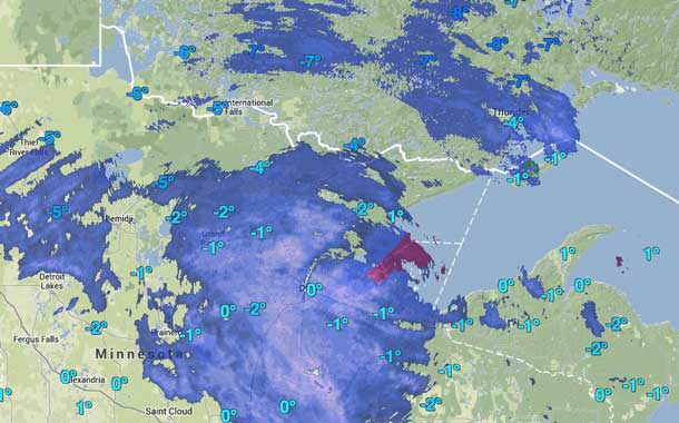
Snow on the way for Thunder Bay
THUNDER BAY – Environment Canada has issued a special weather statement for Thunder Bay. A low pressure system currently located over South Dakota is forecast to track slowly southeastwards. 2 to 4 cm of snow accumulation is expected over northwestern Ontario tonight and Tuesday except 5 cm over the Thunder Bay area tonight due to the lake enhancement.
Based on the current computer guidance, the low pressure system may reach Iowa by late Tuesday, then track northeast towards the Great Lakes.
10 cm of snowfall will be expected over areas near the Minnesota border Tuesday night.
Over northeastern Ontario south of a line from Searchmont eastwards to North Bay, when the warm front associated with the low approaches, precipitation will start as light snow mixed with ice pellets then change to freezing rain early Wednesday morning.
However, there is much uncertainty in the track and development of this low system. If the system track north, significant snow accumulation will spread farther north. Environment Canada will continue to monitor the development of this system closely and update information accordingly or issue watches and warnings if the confidence becomes higher.


