THUNDER BAY – Weather patters across North America are impacted by El Niño and other weather patterns. Across Western Canada there is a noted seven year cycle for snowfall amounts. Across Thunder Bay we are experiencing a slow spring. In Western Canada this year, and in the Maritimes in Newfoundland, snow late into May is ongoing.
El Niño impacts our weather patterns
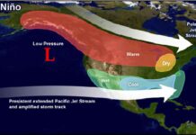
El Niño wreaks havoc across the globe, shifting weather patterns that spawn droughts in some regions and floods in others. The impacts of this tropical Pacific climate phenomenon are well known and documented.
A mystery, however, has remained despite decades of research: Why does El Niño always peak around Christmas and end quickly by February to April?
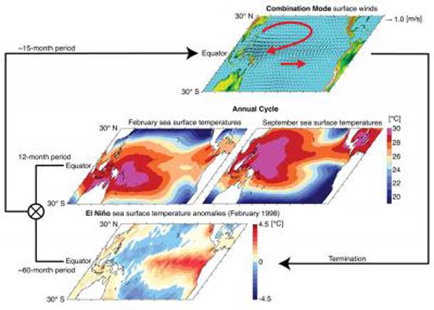
Now there is an answer: An unusual wind pattern that straddles the equatorial Pacific during strong El Niño events and swings back and forth with a period of 15 months explains El Niño’s close ties to the annual cycle. This finding is reported in the May 26, 2013, online issue of Nature Geoscience by scientists from the University of Hawai’i at Manoa Meteorology Department and International Pacific Research Center.
“This atmospheric pattern peaks in February and triggers some of the well-known El Niño impacts, such as droughts in the Philippines and across Micronesia and heavy rainfall over French Polynesia,” says lead author Malte Stuecker.
When anomalous trade winds shift south they can terminate an El Niño by generating eastward propagating equatorial Kelvin waves that eventually resume upwelling of cold water in the eastern equatorial Pacific. This wind shift is part of the larger, unusual atmospheric pattern accompanying El Niño events, in which a high-pressure system hovers over the Philippines and the major rain band of the South Pacific rapidly shifts equatorward.
With the help of numerical atmospheric models, the scientists discovered that this unusual pattern originates from an interaction between El Niño and the seasonal evolution of temperatures in the western tropical Pacific warm pool.
“Not all El Niño events are accompanied by this unusual wind pattern” notes Malte Stuecker, “but once El Niño conditions reach a certain threshold amplitude during the right time of the year, it is like a jack-in-the-box whose lid pops open.”
A study of the evolution of the anomalous wind pattern in the model reveals a rhythm of about 15 months accompanying strong El Niño events, which is considerably faster than the three- to five-year timetable for El Niño events, but slower than the annual cycle.
“This type of variability is known in physics as a combination tone,” says Fei-Fei Jin, professor of Meteorology and co-author of the study. Combination tones have been known for more than three centuries. They where discovered by violin builder Tartini, who realized that our ear can create a third tone, even though only two tones are played on a violin.
“The unusual wind pattern straddling the equator during an El Niño is such a combination tone between El Niño events and the seasonal march of the sun across the equator” says co-author Axel Timmermann, climate scientist at the International Pacific Research Center and professor at the Department of Oceanography, University of Hawai’i. He adds, “It turns out that many climate models have difficulties creating the correct combination tone, which is likely to impact their ability to simulate and predict El Niño events and their global impacts.”
The scientists are convinced that a better representation of the 15-month tropical Pacific wind pattern in climate models will improve El Niño forecasts. Moreover, they say the latest climate model projections suggest that El Niño events will be accompanied more often by this combination tone wind pattern, which will also change the characteristics of future El Niño rainfall patterns.


