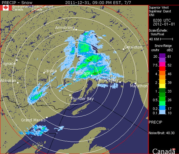
 THUNDER BAY – While a special weather statement is still in effect for Thunder Bay a look at the Radar Image from Environment Canada appears to show that the storm that was forecast to dump up to 15cm of snow on the city may have shifted to the north of Thunder Bay.
Environment Canada still says, “A developing disturbance over Iowa is forecast to intensify and Reach the Great Lakes Sunday morning. Snow is already falling over Northwestern Ontario. The most significant accumulation is likely across the western and northern shores of Lake Superior with close To 15 centimetres possible, the bulk of which is expected from this evening through Sunday morning from Thunder Bay to Marathon. Five to 10 cm is possible across remaining regions of Northwestern Ontario By the time it winds down by early Sunday.
Much of Northeastern Ontario is also slated to receive in the range of 5 to 10 cm of snow, with most of it falling on Sunday.
Colder Arctic air is also expected to envelop Northwestern Ontario later on New Year’s day accompanied by brisk northwesterly winds. This will create some local blowing snow as well as cold wind chills approaching minus 30 Sunday night.
Have fun tonight, and make sure you drive safe and if you are enjoying the season, take a safe way home.
