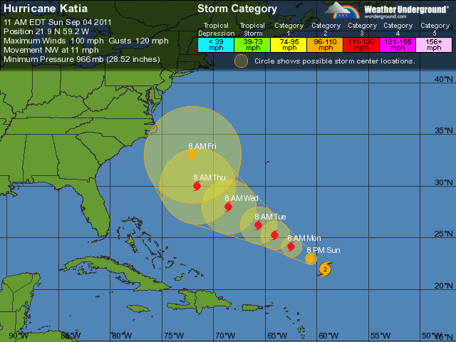
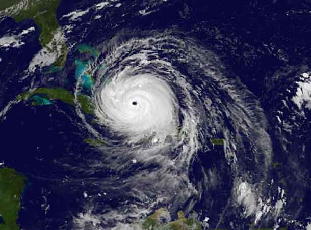
 THUNDER BAY – Hurricane Katia intensified over the past hours to a hurricane again. Katia is now a category two hurricane on the Saffir-Simpson hurricane wind scale. At 1100 am AST (1500 UTC) the center of Hurricane Katia was located near latitude 21.9 north / longitude 59.2 west. Katia is moving toward the northwest near 12 mph (19 km/h) and this general motion is expected to continue through Tuesday. On the forecast track, Katia will remain north of the northern Leeward Islands.
Maximum sustained winds have increased to near 100 mph (160 km/h) with higher gusts. Additional strengthening is forecast during the next couple of days.
Katia could become a major hurricane by Monday. Hurricane-force winds extend outward up to 45 miles(75 km) from the center. Tropical-storm-force winds extend outward up to 175 miles (280 km). NOAA buoy 41044 located just north of the center of Katia recently reported a sustained wind of 90 mph (144 km/h) and a gust to 107 mph (173 km/h).
Swells could begin to affect Bermuda by early next week. These swells are likely to cause life-threatening surf and rip current conditions.
The five day tracking shows that Katia is expected to shift more northward by late in the week. That could put the storm on a track toward Canadian territory.
[ad#Google Adsense 350×250 sidebaradd]


