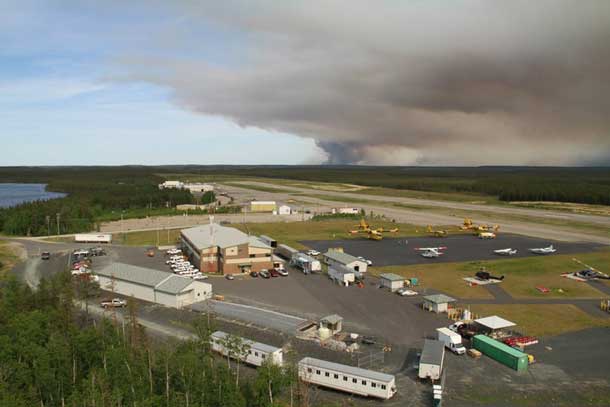
THUNDER BAY – “More rain fell across a majority of the region overnight and throughout the day, keeping our fire hazard low. The rain also helped fire crews near Pikangikum First Nation declare a small fire out last night, bringing our total fires in the region down to two,” according to MNR.
The fire hazard in the Northwest Region is a sharp contrast to Northeastern Ontario.
MNR reports, “Kenora Fire #36 continues to be the top priority fire in the region, however it as well has been benefiting from the precipitation. By days end the NWR will have over 200 FireRangers, 75 overhead staff and 23 aircraft supporting fire suppression efforts in the eastern half of the province”.
The fire hazard based on more rainfall in the forecast for much of Northwestern Ontario should remain stable.
In Northeastern Ontario, the situation is different, although there are reports of precipitation in the Timmins area.
Timmins 9, north of Gogama is currently mapped at 21088 has in size. The fire has increased in size, however smoke has restricted visibility not allowing aircraft to remap the size. The fire is exhibiting extreme behaviour due to high winds. Conditions are changing quickly and it expected that the fire will continue to grow. At this time, the fire is approximately 1 km south of highway 101 and 2 km east of highway 144. At this time, the highways remain closed. Smoke and ash will affect the City of Timmins and surrounding areas. Values protections continues on the fire by FireRanger crews, and 500 sprinklers have been installed on values. Fire crews continue to arrive on this fire daily to assist with efforts. An MNR incident management team is also on-site. The safety of the public and our crews is our top priority. The municipality of Timmins has declared a state of emergency. Mattagami First Nation evacuated on Wednesday as a precautionary measure for the health and safety of residents of the community. Due to variable winds and the risk of smoke in the area, the areas south of Hydro Bay to north of Lamotte Lake Road are currently being evacuated. This includes the areas east of Kenogamissi. This does not include Hydro Bay proper; however this area should be on alert. Smoke alerts are in effect for Gogama and Timmins. Elderly persons and people affected by asthma or respiratory illnesses should take necessary precautions.
Kirkland Lake 8 is currently 2757.0 hectares in size. Five helicopters worked on the fire today, as well as FireRangers continuing values protection on values in the area. Crews also continue to check on values protection already in place. The Municipality has closed Goldthorpe road, Goodfish road and restricted access to both areas. An Implementation order was approved on May 21st for a MNR District emergency area order. Evacuations that were previously in place remain at this time. The municipality has made arrangements for evacuees to stay at the Kirkland Lake Royal Canadian Legion, while some evacuees are making arrangements with family or friends. The town of Kirkland Lake has been running radio ads with fire information and town evacuation updates.
For information regarding evacuation and road closures in the Kirkland Lake area, please call the Kirkland Lake Municipal Office at 705-567-9365 ext. 221.
